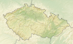
Rokytnice nad Rokytnou
Rokytnice nad Rokytnou | |
|---|---|
 Centre of Rokytnice nad Rokytnou | |
| Coordinates: 49°11′4″N 15°46′22″E / 49.18444°N 15.77278°E | |
| Country | |
| Region | Vysočina |
| District | Třebíč |
| First mentioned | 1190 |
| Area | |
• Total | 8.08 km2 (3.12 sq mi) |
| Elevation | 535 m (1,755 ft) |
| Population (2024-01-01)[1] | |
• Total | 834 |
| • Density | 100/km2 (270/sq mi) |
| Time zone | UTC+1 (CET) |
| • Summer (DST) | UTC+2 (CEST) |
| Postal code | 675 25 |
| Website | www |
Rokytnice nad Rokytnou is a market town in Třebíč District in the Vysočina Region of the Czech Republic. It has about 800 inhabitants.
Geography
[edit]Rokytnice nad Rokytnou is located about 8 kilometres (5 mi) southwest of Třebíč and 27 km (17 mi) southeast of Jihlava. It lies in the Jevišovice Uplands. The highest point is at 587 m (1,926 ft) above sea level. The upper course of the Rokytná River flows through the market town.
History
[edit]The first written mention of Rokytnice is in the foundation deed of the Louka Monastery from 1190. It was owned by various lower nobles. From 1695, it was part of the Sádek estate.[2]
In 1880, Rokytnice nad Rokytnou was promoted to a market town.[3]
Demographics
[edit]
|
|
| ||||||||||||||||||||||||||||||||||||||||||||||||||||||
| Source: Censuses[4][5] | ||||||||||||||||||||||||||||||||||||||||||||||||||||||||
Transport
[edit]The I/23 road (the section from Třebíč to Jindřichův Hradec) passes through the northern part of the municipal territory.
Sights
[edit]The main landmark is the Church of Saint John the Baptist. It has a Romanesque core. It was rebuilt into its present Baroque form in 1750.[6][7]
References
[edit]- ^ "Population of Municipalities – 1 January 2024". Czech Statistical Office. 2024-05-17.
- ^ "Z historie městyse" (in Czech). Městys Rokytnice nad Rokytnou. Retrieved 2023-09-04.
- ^ "Města a městyse v ČR – 2006 – Vysočina" (in Czech). Czech Statistical Office. Retrieved 2024-03-04.
- ^ "Historický lexikon obcí České republiky 1869–2011" (in Czech). Czech Statistical Office. 2015-12-21.
- ^ "Population Census 2021: Population by sex". Public Database. Czech Statistical Office. 2021-03-27.
- ^ "Kostel sv. Jana Křtitele se sochami" (in Czech). National Heritage Institute. Retrieved 2023-09-04.
- ^ "Kostel sv. Jana Křtitele" (in Czech). Římskokatolická farnost Rokytnice nad Rokytnou. Retrieved 2023-09-04.


