Sant Andreu de Llavaneres
Sant Andreu de Llavaneres | |
|---|---|
 Town hall and church | |
| Coordinates: 41°34′24″N 2°28′58″E / 41.57333°N 2.48278°E | |
| Country | |
| Community | |
| Province | Barcelona |
| Comarca | Maresme |
| Government | |
| • Mayor | Joan Mora Buch (2015)[1] |
| Area | |
• Total | 11.8 km2 (4.6 sq mi) |
| Elevation | 125 m (410 ft) |
| Population (2018)[3] | |
• Total | 10,877 |
| • Density | 920/km2 (2,400/sq mi) |
| Demonym(s) | Llavanerenc, llavanerenca |
| Website | santandreudellavaneres |
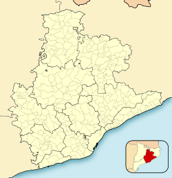
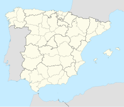
Sant Andreu de Llavaneres (Catalan pronunciation: [ˈsant ənˈdɾew ðə ʎəβəˈneɾəs]) is a municipality located 36 km north of Barcelona (Catalonia) (Spain), along the Mediterranean coast, between Mataró and Sant Vicenç de Montalt. It belongs to the Maresme comarca and the Barcelona province. The short name is simply Llavaneres.
Llavaneres faces the sea to the east and a natural park to the west. The village has a mixed agricultural and residential character and has become a popular vacation and summer-residence location for people living in Barcelona over the last forty years.
Good connections with Barcelona, the Maresme coast and the Mediterranean axis of France and Spain include a train line to Barcelona, as well as the C-32 highway and the N-2 road.
Sant Andreu de Llavaneres is today well known for its upscale sailing in summer.[citation needed]
History
[edit]The oldest archaeological remains are from the Neolithic, especially the rocks of "Sant Magí" in the mountains of Montalt. Between the rivers Llavaneres and les Bruixes, the village Can Sanç dates from Roman times, where vineyards and olive trees were cultivated. The economic activity, as in Mataro and other communities, was purely agricultural.[4] Later called Sant Andreu de Llavaneres, it was part of Mataro and gained independence in the mid-sixteenth century. Sant Andreu de Llavaneres became the resort of the better society of Barcelona (1920). Several of his modernist buildings, built by architects like Joaquim Lloret i Homs, date from this period.[5]
Demography
[edit]| 1900 | 1930 | 1950 | 1970 | 1986 | 2007 |
|---|---|---|---|---|---|
| 1129 | 1508 | 1758 | 2573 | 3432 | 9745 |
References
[edit]- ^ "Ajuntament de Sant Andreu de Llavaneres". Generalitat of Catalonia. Retrieved 2015-11-13.
- ^ "El municipi en xifres: Sant Andreu de Llavaneres". Statistical Institute of Catalonia. Retrieved 2015-11-23.
- ^ Municipal Register of Spain 2018. National Statistics Institute.
- ^ "Història local". Ajuntament de Sant Andreu de Llavaneres (in Catalan). Retrieved 2017-09-08.
- ^ "Relat "CASES DE JOAQUIM LLORET HOMS. SANT ANDREU DE LLAVANERES"". relatsencatala.cat (in Spanish). Retrieved 2017-09-08.
- Panareda Clopés, Josep Maria; Rios Calvet, Jaume; Rabella Vives, Josep Maria (1989). Guia de Catalunya, Barcelona: Caixa de Catalunya. ISBN 84-87135-01-3 (Spanish). ISBN 84-87135-02-1 (Catalan).
External links
[edit]- Official website (in Catalan)
- Government data pages (in Catalan)
- Historic-artistic heritage


