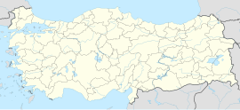
Sarıyayla, Nazımiye
Appearance
Sarıyayla | |
|---|---|
| Coordinates: 39°17′17″N 39°58′30″E / 39.288°N 39.975°E | |
| Country | Turkey |
| Province | Tunceli |
| District | Nazımiye |
| Population (2021) | 129 |
| Time zone | UTC+3 (TRT) |
Sarıyayla (Kurdish: Civarik) is a village in the Nazımiye District, Tunceli Province, Turkey.[1] The village is populated by Kurds of the Hormek tribe and had a population of 129 in 2021.[2][3]
The hamlets of Bahtiyar, Balık (Baliq), Kemik (Kemyek), Kılıçlar, Kuzguncuk, Tutuklu and Yaylacık are attached to the village.[1]
References
[edit]- ^ a b "Türkiye Mülki İdare Bölümleri Envanteri". T.C. İçişleri Bakanlığı (in Turkish). Retrieved 19 December 2022.
- ^ "Address-based population registration system (ADNKS) results dated 31 December 2021" (XLS) (in Turkish). TÜİK. Retrieved 30 January 2023.
- ^ Bayrak, Mehmet (1994). Kürdoloji belgeleri: açık - gizli, resmi - gayrıresmi (in Turkish). ÖZGE Yayınları. p. 283.
