Shalanky
Appearance
Shalanky | |
|---|---|
Village | |
| Coordinates: 48°13′40″N 22°53′2″E / 48.22778°N 22.88389°E | |
| Country | |
| Oblast | |
| Raion | |
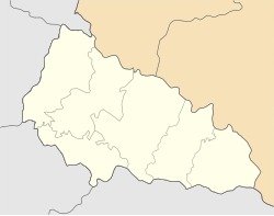
Shalanky[1] (Ukrainian: Шаланки, Hungarian: Salánk) is a village in western Ukraine, within Berehove Raion of Zakarpattia Oblast, but was formerly administered as part of Vynohradiv Raion.
Geography
[edit]The village is located around 16 km northwest of Vynohradiv on the bank of the brook Borzsa. Administratively, the village belongs to the Berehove Raion, Zakarpattia Oblast.
Population
[edit]The population includes 3110 inhabitants, mostly Hungarians, with a density of 0,280 people / km2[2]
Notes
[edit]- ^ "Shalanki, Ukraine - Geographical Names, map, geographic coordinates".
- ^ "Офіційний портал Верховної Ради України". w1.c1.rada.gov.ua. Archived from the original on 2013-12-02.

