Simonésia
Appearance
From Wikipedia, the free encyclopedia
Municipality of Minas Gerais, Brazil

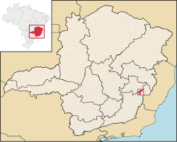
Simonésia is a Brazilian municipality located in the state of Minas Gerais. Its discovery is generally credited to the explorers Luciano Galo Nunes and Manuel Antônio Meira. The name of the city is derived from Simon the Zealot, the saint of the city. The city belongs to the mesoregion of Zona da Mata and to the microregion of Manhuaçu. As of 2020, the estimated population was 19,736.[1]
The municipality holds part of the Sossego Forest Biological Station.[2]
See also
[edit]References
[edit]- ^ IBGE 2020
- ^ Aprovado o Plano de Manejo da RPPN Estação Biológica Mata do Sossego, no Município de Simonésia e Manhuaçú/MG (in Portuguese), rppnweb, retrieved 2017-03-15
20°07′26″S 42°00′03″W / 20.12389°S 42.00083°W / -20.12389; -42.00083
This geographical article relating to Minas Gerais is a stub. You can help Wikipedia by expanding it. |
