Jump to content

Suong Municipality

Coordinates: 11°54′41″N 105°39′07″E / 11.91139°N 105.65194°E / 11.91139; 105.65194
From Wikipedia, the free encyclopedia
Suong Municipality
ក្រុងសួង
Krong Suong
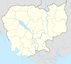
Suong Municipality is located in Cambodia
Suong Municipality
Suong Municipality
Location in Cambodia
Coordinates: 11°54′40″N 105°51′15″E / 11.91111°N 105.85417°E / 11.91111; 105.85417
Country Cambodia
ProvinceTboung Khmum
CapitalSuong
Elevation
29 m (95 ft)
Population
 (2008)
 • Total29,761
Time zoneUTC+07:00 (ICT)
District Code2517

Suong (Khmer: សួង, lit.'The Suong's Betel') is a municipality (krong) of Tboung Khmum Province in eastern Cambodia.[1]

Administration

[edit]
Sangkat (quarters) Phum (villages)
Suong
  • Cheung Lang
  • Chrak Poun
  • Chrey Bet Meas
  • Chong Angkrang
  • Phum Bei Dab
  • Phum Dabprambei
  • Phum Saeprambei
  • Ponnareay
  • Pou Kel
  • Prey Totueng
  • Suong Kaeut
  • Suong Lech
  • Thlok
  • Toung
  • Vihear Khpos
Vihear Luong
  • Cheung Voat
  • Chi Kae
  • Chruoy
  • Kandal
  • Kien Rung
  • Krachhan
  • Phum Prammuoy Dab
  • Phum Prammuoy Dabpir
  • Phum Pram Dab
  • Pnov
  • Prasrae Kraom
  • Prasrae Leu
  • Thmei
  • Thnal Thmei
  • Veal Char

References

[edit]
  1. ^ "Index Map2-25. Districts and Communes in Tboung Khmum Province" (PDF). National Institute of Statistics, Ministry of Planning (Cambodia). 2013-12-31.
[edit]

11°54′41″N 105°39′07″E / 11.91139°N 105.65194°E / 11.91139; 105.65194

pFad - Phonifier reborn

Pfad - The Proxy pFad of © 2024 Garber Painting. All rights reserved.

Note: This service is not intended for secure transactions such as banking, social media, email, or purchasing. Use at your own risk. We assume no liability whatsoever for broken pages.


Alternative Proxies:

Alternative Proxy

pFad Proxy

pFad v3 Proxy

pFad v4 Proxy