Thathan Buzurg
Appearance
Thathan Buzurg | |
|---|---|
Village | |
| Coordinates: 25°44′58.5″N 85°14′33.0″E / 25.749583°N 85.242500°E | |
| Country | India |
| State | Bihar |
| District | Vaishali |
| Assembly Constituency | Hajipur[1] |
| Languages | |
| • Official | Hindi |
| Time zone | UTC+5:30 (IST) |
| ISO 3166 code | IN-BR |
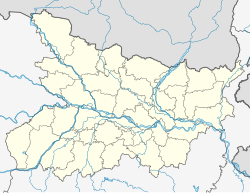
Thathan Buzurg is a village located in the Hajipur block of Vaishali district, Bihar, India. The Hajipur is the closest town and is 6 km from the village.[2]
The village is governed by a gram panchayat which also includes other villages.[3]
| s.n | villages | |
|---|---|---|
| 1 | Rasulpur Bhoj Urf Adharpur | |
| 2 | Bedaulia | |
| 3 | Ghoswar | |
| 4 | Fatehpur Ekara Urf Moghlani | |
| 5 | Thathan Buzurg | |
| 6 | Kazipur Thathan | |
| 7 | Fatehpur Chiraimar | |
| 8 | Ekara | |
| 9 | Kutubpur Ekara | |
| 10 | Chak Kutubpur Matwalia | |
References
[edit]- ^ "Assembly Constituency AC123, Hajipur" (PDF). The Chief Electoral Officer, Bihar. Retrieved 12 July 2015.
- ^ village profile census government official website State - Bihar, District- vaishali, Sub District - Hajipur
- ^ "Census Villages mapped for Thathan Buzurg". National Panchayat Portal. Panchayat Informatics Division. 26 September 2014. Retrieved 12 July 2015.

