Tschuggen
Appearance
| Tschuggen | |
|---|---|
 Tschuggen with ancient astronomical observatory | |
| Highest point | |
| Elevation | 2,049 m (6,722 ft) |
| Prominence | 34 m (112 ft)[1] |
| Parent peak | Aroser Weisshorn |
| Coordinates | 46°47′0″N 9°39′52″E / 46.78333°N 9.66444°E |
| Geography | |
| Location | Graubünden, Switzerland |
| Parent range | Plessur Alps |
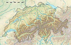
The Tschuggen is a mountain of the Plessur Alps, overlooking Arosa in the Swiss canton of Graubünden.
A gondola lift and a chairlift link the top of the mountain with the town and resort of Arosa — the base station of the chairlift is near to Arosa railway station.
Near the summit are located an observatory and a mountain hut.
References
[edit]External links
[edit]
