Węsiory
Appearance
Węsiory | |
|---|---|
Village | |
 The church in Węsiory | |
| Coordinates: 54°13′52″N 17°50′36″E / 54.23111°N 17.84333°E | |
| Country | |
| Voivodeship | Pomeranian |
| County | Kartuzy |
| Gmina | Sulęczyno |
| Population | 745 |
| Website | http://wesiory.pl/ |
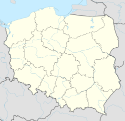
Węsiory [vɛ̃ˈɕɔrɨ] is a village in the administrative district of Gmina Sulęczyno, within Kartuzy County, Pomeranian Voivodeship, in northern Poland.[1] The village lies approximately 5 kilometres (3 mi) east of Sulęczyno, 26 km (16 mi) south-west of Kartuzy, and 54 km (34 mi) west of the regional capital Gdańsk.
For details of the history of the region, see History of Pomerania.
Near the village is a concentration of stone circles and burial places of the Wielbark Culture.[2]
References
[edit]- ^ "Central Statistical Office (GUS) - TERYT (National Register of Territorial Land Apportionment Journal)" (in Polish). 2008-06-01.
- ^ Adam Cieśliński, "Chapter 7: The society of Wielbark culture, AD 1–300", in: Przemysław Urbańczyk, ed., The Past Societies: Polish Lands From the First Evidence of Human Presence to the Early Middle Ages, Vol. 4: 500 BC–500 AD, ed. Aleksandra Rzeszotarska-Nowakiewicz, trans. Anna Kinecka, Warsaw: Institute of Archaeology and Ethnology, Polish Academy of Sciences, 2016, pp. 217–55, pp. 224, 234, 238.
Gallery - Iron Age stone circles and burial places
[edit]


