Jump to content

Walchum

Coordinates: 52°55′49″N 7°16′15″E / 52.9303°N 7.2707°E / 52.9303; 7.2707
From Wikipedia, the free encyclopedia
Walchum
Coat of arms of Walchum
Location of Walchum within Emsland district
NetherlandsCloppenburg (district)County of Bentheim (district)Leer (district)Osnabrück (district)AndervenneBawinkelBeestenBockhorstBörgerBreddenbergDersumDörpenDohrenEmsbürenEsterwegenFrerenFresenburgGeesteGerstenGroß BerßenHandrupHarenHaselünneHeedeHerzlakeHilkenbrookHüvenKlein BerßenKluseLähdenLahnLangenLathenLeheLengerichLingenLorupLünneLünneMeppenMessingenNeubörgerNeuleheNiederlangenOberlangenPapenburgRastdorfRenkenbergeRhedeSalzbergenSchapenSögelSpahnharrenstätteSpelleStavernSurwoldSustrumThuineTwistVreesWalchumWerlteWerpelohWettrupWippingen
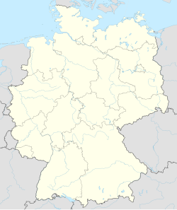
Walchum is located in Germany
Walchum
Walchum
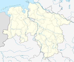
Walchum is located in Lower Saxony
Walchum
Walchum
Coordinates: 52°55′49″N 7°16′15″E / 52.9303°N 7.2707°E / 52.9303; 7.2707
CountryGermany
StateLower Saxony
DistrictEmsland
Municipal assoc.Dörpen
Government
 • MayorAlois Milsch (CDU)
Area
 • Total
26.49 km2 (10.23 sq mi)
Elevation
6 m (20 ft)
Population
 (2022-12-31)[1]
 • Total
1,683
 • Density64/km2 (160/sq mi)
Time zoneUTC+01:00 (CET)
 • Summer (DST)UTC+02:00 (CEST)
Postal codes
26907
Dialling codes04963
Vehicle registrationEL
Websitewww.Walchum.de

Walchum is a municipality in the Emsland district, in Lower Saxony, Germany.[2]

References

[edit]
  1. ^ "LSN-Online Regionaldatenbank, Tabelle A100001G: Fortschreibung des Bevölkerungsstandes, Stand 31. Dezember 2022" (in German). Landesamt für Statistik Niedersachsen.
  2. ^ official website
[edit]
  • Media related to Walchum at Wikimedia Commons


pFad - Phonifier reborn

Pfad - The Proxy pFad of © 2024 Garber Painting. All rights reserved.

Note: This service is not intended for secure transactions such as banking, social media, email, or purchasing. Use at your own risk. We assume no liability whatsoever for broken pages.


Alternative Proxies:

Alternative Proxy

pFad Proxy

pFad v3 Proxy

pFad v4 Proxy