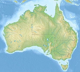
Western Eyre Marine Park
| Western Eyre Marine Park Australia | |
|---|---|
| Nearest town or city | Streaky Bay, South Australia |
| Coordinates | 34°13′01″S 134°21′38″E / 34.2169°S 134.3605°E |
| Established | 8 December 2012[1] |
| Area | 57,946 km2 (22,373.1 sq mi)[2] |
| Managing authorities | Director of National Parks |
| Website | Western Eyre Marine Park |
| Footnotes | Coordinates[3] Nearest town[4] |

Western Eyre Marine Park (formerly Western Eyre Commonwealth Marine Reserve) is a marine protected area located in the Great Australian Bight south of South Australia in waters within the Australian Exclusive economic zone.[2]
It was gazetted in November 2012.[1]
The marine park consists of three zones - a marine national park zone (IUCN Category II) which occupies three separate areas of ocean with a total area of 17,439 square kilometres (6,733 square miles), a multiple use zone (IUCN Category VI) with an area of 16,107 square kilometres (6,219 square miles) and a special purpose zone (IUCN Category VI) with an area of 24,400 square kilometres (9,400 square miles).[2][4]
It is part of the group of Australian marine parks known as the South-West Marine Park Network.[2]
It lies east of the Great Australian Bight Marine Park.[5]
See also
[edit]Notes
[edit]- ^ a b "Environment Protection and Biodiversity Conservation (Commonwealth Marine Reserves) Proclamation 2012 - F2012L02188". Commonwealth of Australia, Comlaw. Retrieved 19 March 2015.
- ^ a b c d "Western Eyre Commonwealth Marine Reserve". Department of the Environment and Energy. Retrieved 27 April 2017.
- ^ "Summary of Commonwealth Marine Protected Areas by Type (refer "Detailed List" tab)". Collaborative Australian Protected Area Database (CAPAD). Department of the Environment. Retrieved 27 April 2017.
- ^ a b "Western Eyre Commonwealth Marine Reserve - Maps". Department of the Environment and Energy. Retrieved 27 April 2017.
- ^ [1] Map
External links
[edit]- Oficial webpage
- Webpage for the Western Eyre Commonwealth Marine Reserve on the Protected Planet website
- Interactive Map, Commonwealth marine reserves
![]() This article incorporates text available under the CC BY 3.0 AU licence. Required attribution: © Commonwealth of Australia 2013
This article incorporates text available under the CC BY 3.0 AU licence. Required attribution: © Commonwealth of Australia 2013
