Witkowo
Witkowo | |
|---|---|
 People's Bank in Witkowo | |
| Coordinates: 52°26′11″N 17°46′27″E / 52.43639°N 17.77417°E | |
| Country | |
| Voivodeship | Greater Poland |
| County | Gniezno |
| Gmina | Witkowo |
| First mentioned | 1363 |
| Town rights | 1676 |
| Area | |
• Total | 8.3 km2 (3.2 sq mi) |
| Population (2006) | |
• Total | 7,855 |
| • Density | 950/km2 (2,500/sq mi) |
| Time zone | UTC+1 (CET) |
| • Summer (DST) | UTC+2 (CEST) |
| Postal code | 62-230 |
| Vehicle registration | PGN |
| Climate | Dfb |
| Voivodeship road | |
| Website | http://www.witkowo.pl |
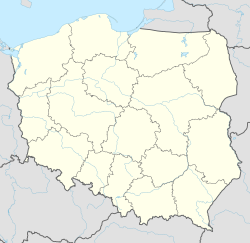
Witkowo ([vitˈkɔvɔ]) is a town in Gniezno County, Greater Poland Voivodeship, Poland, located southeast of Poznań.
History
[edit]Witkowo was first mentioned in a document from 1363. It was a private village of Polish nobility of the Kingdom of Poland, administratively located in the Gniezno County in the Kalisz Voivodeship in the Greater Poland Province.[1] In 1676, it was granted town rights.
Following the joint German-Soviet invasion of Poland, which started World War II in September 1939, the town was occupied by Germany until 1945. Local units of the Grey Ranks and Wielkopolska Organizacja Wojskowa Polish resistance organizations were founded already in 1939, and the latter became part of the larger Wojskowa Organizacja Ziem Zachodnich organization in 1940.[2] Klemens Jan Grygiel, commander of the local unit of the Grey Ranks, and Edward Paulus, founder of the local unit of the Union of Armed Struggle, were arrested by the Germans in mid-1942, and eventually sentenced to death and executed in Rawicz the following year.[3]
Cuisine
[edit]Witkowo is one of the production sites of the Greater Poland liliput cheese (ser liliput wielkopolski), a traditional regional Polish cheese, protected as a traditional food by the Ministry of Agriculture and Rural Development of Poland.[4]
References
[edit]- ^ Atlas historyczny Polski. Wielkopolska w drugiej połowie XVI wieku. Część I. Mapy, plany (in Polish). Warszawa: Instytut Historii Polskiej Akademii Nauk. 2017. p. 1b.
- ^ Encyklopedia konspiracji Wielkopolskiej 1939–1945 (in Polish). Poznań: Instytut Zachodni. 1998. pp. 187, 627, 646. ISBN 83-85003-97-5.
- ^ Encyklopedia konspiracji Wielkopolskiej 1939–1945. pp. 188, 423.
- ^ "Ser liliput wielkopolski". Ministerstwo Rolnictwa i Rozwoju Wsi - Portal Gov.pl (in Polish). Retrieved 30 May 2021.


