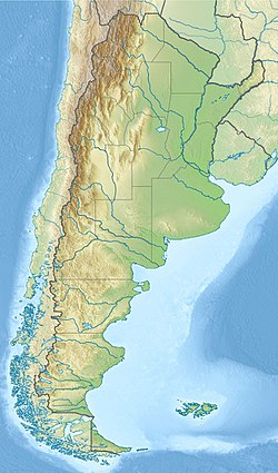
Golfo San Matias
Aspekto
| Golfo San Matias | ||
|---|---|---|
| golfeto [+] | ||
| Akvejo | Atlantiko | |
| Koordinatoj | 41° 30′ 0″ S, 64° 15′ 0″ U (mapo)-41.5-64.25Koordinatoj: 41° 30′ 0″ S, 64° 15′ 0″ U (mapo) | |
| Larĝo | 140 km (87 mi) | |
| Profundo | 160 km (99 mi) | |
 |
||
| Golfo San Matias | ||
La Golfo San Matias (Golfo San Matías) estas golfo de la Atlantika Oceano ĉe la marbordo de Patagonio, Argentino. Ĝi limas kun la Provinco Rio Negro norde kaj okcidente, kaj la duoninsulo Valdés de Ĉubutio sude. Ĝi estas "unu el plej grandaj golfoj en Patagonio".[1]
La golfo estis celo de scienca priserĉado pro sia malkutimaj grandaj sablotajdoj kaj ties movoj.[2]
La loka fiŝkaptada industrio povas iĝis neneltenebla pro troa fiŝkaptado de diversaj specioj.
41° 30′ S 64° 30′ U / 41.500 °S, 64.500 °U (mapo)
Notoj
[redakti | redakti fonton]- ↑ Maria Cintia Piccolo. (2005) “Oceanography of the western South Atlantic continental shelf from 33 to 55°S”, Kenneth H. Brink & Allan R. Robinson: The Global Coastal Ocean: Regional Studies and Syntheses, The Sea: Ideas and Observations on Progress in the Study of the Seas 11. Harvard University Press, p. 253–330. ISBN 9780674017412.
- ↑ C. L. So; J. W. Pierce & F. R. Siegel (1974). “Sand waves in the Gulf of San Matias, Argentina”, Geografiska Annaler, Series A: Physical Geography 56 (3/4), p. 227–235.


