Castellarano
Apariencia
| Castellarano | ||
|---|---|---|
| Entidad subnacional | ||
 | ||
 Escudo | ||
|
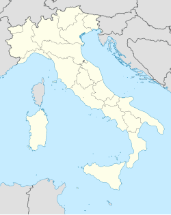
Localización de Castellarano en Italia | ||
 | ||
| Coordenadas | 44°30′50″N 10°44′02″E / 44.513888888889, 10.733888888889 | |
| Capital | Castellarano | |
| Idioma oficial | Italiano | |
| Entidad | Comuna de Italia | |
| • País | Italia | |
| • Región | Emilia-Romaña | |
| • Provincia | Reggio Emilia | |
| Fracciones | Cà de Fii, Ca' de Grimaldi, Ca' de Ravazzini, Cadiroggio, Case Ferri, Castello La Croce, Farneto di Sotto, Le Ville, Malee, Montebabbio, Pradivia, Roteglia, San Valentino, Scuole, Telarolo, Tressano | |
| Municipios limítrofes | Baiso, Casalgrande, Prignano sulla Secchia (MO), Sassuolo (MO), Scandiano, Viano | |
| Superficie | ||
| • Total | 57,49 km² | |
| Altitud | ||
| • Media | 149 m s. n. m. | |
| Población (31-10-2009 (fonte ISTAT)) | ||
| • Total | 14,972 hab. | |
| • Densidad | 259 hab./km² | |
| Gentilicio | castellaranesi | |
| Huso horario | CET (UTC +1) | |
| • en verano | CEST (UTC +2) | |
| Código postal | 42014[1] | |
| Prefijo telefónico | 0536 | |
| Matrícula | RE | |
| Código ISTAT | 035014 | |
| Código catastral | C141[2] | |
| Fiestas mayores | 12 de mayo | |
| Patrono(a) | Pancracio | |
| Sitio web oficial | ||
Castellarano es un municipio situado en el territorio de la Provincia de Reggio Emilia, en Emilia-Romaña, (Italia).
Demografía
[editar]| Gráfica de evolución demográfica de Castellarano entre 1861 y 2001 |
 |
|
Fuente ISTAT - elaboración gráfica de Wikipedia |
Enlaces externos
[editar]- ↑ Worldpostalcodes.org, código postal n.º 42014.
- ↑ «Codici Catastali». Comuni-italiani.it (en italiano). Consultado el 29 de abril de 2017.
