Ilshofen
| Ilshofen | ||
|---|---|---|
| Ciudad | ||
 | ||
 Escudo | ||
|
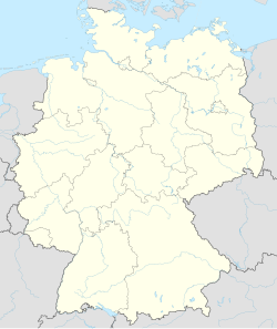
Localización de Ilshofen en Alemania | ||
 | ||
| Coordenadas | 49°10′13″N 9°55′13″E / 49.170277777778, 9.9202777777778 | |
| Entidad | Ciudad | |
| • País |
| |
| • Estado |
| |
| • Distrito | Schwäbisch Hall | |
| Superficie | ||
| • Total | 53,57 km² | |
| Altitud | ||
| • Media | 441 m s. n. m. | |
| Población (2022) | ||
| • Total | 7089 hab. | |
| • Densidad | 129,2 hab./km² | |
| Huso horario | UTC+01:00 y UTC+02:00 | |
| Código postal | 74532[1] | |
| Prefijo telefónico | 07904 | |
| Matrícula | SHA | |
| Número oficial de comunidad | 08127043 | |
| Sitio web oficial | ||
Ilshofen es una ciudad alemana perteneciente al distrito de Schwäbisch Hall de Baden-Wurtemberg.
Localización
[editar]Se ubica junto a la autovía A6, a medio camino entre Stuttgart y Núremberg, unos 15 km al noreste de la capital distrital Schwäbisch Hall.[2]
Historia
[editar]Se conoce la existencia de la localidad desde 1288, cuando se menciona como un territorio de los condes de Flügelau. En 1330, el emperador Luis IV de Baviera le concedió el título de ciudad. Con el tiempo, la casa de Hohenlohe vendió la ciudad para pagar sus deudas a las ciudades imperiales de Dinkelsbühl, Rothenburg ob der Tauber y Schwäbisch Hall, quedándose finalmente esta ciudad con todo el territorio de Ilshofen hasta su incorporación a Wurtemberg en 1802.[3][4]
Entre 1971 y 1975, el territorio de la ciudad aumentó con la incorporación de los hasta entonces municipios de Eckartshausen, Obersteinach, Ruppertshofen y Unteraspach.[5]
Demografía
[editar]A 31 de diciembre de 2017 tiene 6470 habitantes.[6]
Referencias
[editar]- ↑ Worldpostalcodes.org, código postal n.º 74532.
- ↑ Mapa de Ilshofen Google Maps
- ↑ «Regesta Imperii des Kaisers Ludwig des Bayern vom 7. August 1330». Archivado desde el original el 29 de mayo de 2019. Consultado el 29 de mayo de 2019.
- ↑ Das Land Baden-Württemberg. Amtliche Beschreibung nach Kreisen und Gemeinden sowie die abgegangene Ortschaft Bonazhof. Band IV: Regierungsbezirk Stuttgart, Regionalverbände Franken und Ostwürttemberg. Kohlhammer, Stuttgart 1980, ISBN 3-17-005708-1. S. 491–496
- ↑ Statistisches Bundesamt (Hrsg.): Historisches Gemeindeverzeichnis für die Bundesrepublik Deutschland. Namens-, Grenz- und Schlüsselnummernänderungen bei Gemeinden, Kreisen und Regierungsbezirken vom 27.5.1970 bis 31.12.1982. W. Kohlhammer, Stuttgart/Mainz 1983, ISBN 3-17-003263-1, S. 456, S. 457, S. 468.
- ↑ Statistisches Landesamt Baden-Württemberg – Bevölkerung nach Nationalität und Geschlecht am 31. Dezember 2017 (CSV-Datei)
Enlaces externos
[editar] Wikimedia Commons alberga una categoría multimedia sobre Ilshofen.
 Ilshofen en OpenStreetMap.
