Vai al contenuto

Hambleton

Coordinate: 54°20′N 1°25′W
Da Wikipedia, l'enciclopedia libera.
Disambiguazione – Se stai cercando altri significati, vedi Hambleton (disambigua).
Distretto di Hambleton
Distretto
Distretto di Hambleton – Veduta
Localizzazione
StatoRegno Unito (bandiera) Regno Unito
   Inghilterra (bandiera) Inghilterra
RegioneYorkshire e Humber
Contea North Yorkshire
Amministrazione
CapoluogoNorthallerton
EsecutivoConservatore
Territorio
Coordinate
del capoluogo
54°20′N 1°25′W
Superficie1 311,17 km²
Abitanti91 594 (2019)
Densità69,86 ab./km²
Altre informazioni
Fuso orarioUTC+0
Codice ONS36UC
Rappresentanza parlamentareCollegio di Richmond and Northallerton, di Thirsk and Malton
Cartografia
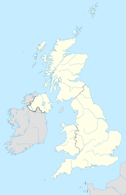
Distretto di Hambleton – Mappa
Localizzazione nella contea di North Yorkshire
Sito istituzionale

Hambleton è un distretto del North Yorkshire, Inghilterra, Regno Unito, con sede a Northallerton.

Il distretto fu creato con il Local Government Act 1972, il 1º aprile 1974 dalla fusione del distretto urbano di Northallerton con il distretto rurale di Bedale, il distretto rurale di Easingwold, il distretto rurale di Northallerton, parte del distretto rurale di Thirsk e del distretto rurale di Croft.

Parrocchie civili

[modifica | modifica wikitesto]
  • Ainderby Mires with Holtby
  • Ainderby Quernhow
  • Ainderby Steeple
  • Aiskew
  • Aldwark
  • Alne
  • Angram Grange
  • Appleton Wiske
  • Bagby
  • Balk
  • Bedale
  • Beningbrough
  • Bilsdale Midcable
  • Birdforth
  • Birkby
  • Boltby
  • Borrowby
  • Brafferton
  • Brandsby-cum-Stearsby
  • Brompton
  • Burneston
  • Burrill with Cowling
  • Carlton
  • Carlton Husthwaite
  • Carlton Miniott
  • Carthorpe
  • Catton
  • Clifton-on-Yore
  • Cotcliffe
  • Cowesby
  • Coxwold
  • Crakehall
  • Crathorne
  • Crayke
  • Crosby
  • Dalby-cum-Skewsby
  • Dalton
  • Danby Wiske with Lazenby
  • Deighton
  • Easby
  • Easingwold
  • East Cowton
  • East Harlsey
  • East Rounton
  • East Tanfield
  • Eldmire with Crakehill
  • Ellerbeck
  • Exelby, Leeming and Newton
  • Faceby
  • FFarlington
  • Fawdington
  • Felixkirk
  • Firby
  • Flawith
  • Gatenby
  • Girsby
  • Great and Little Broughton
  • Great Ayton
  • Great Busby
  • Great Langton
  • Great Smeaton
  • Hackforth
  • Helperby
  • High Worsall
  • Holme
  • Hood Grange
  • Hornby
  • Howe
  • Howgrave
  • Huby
  • Husthwaite
  • Hutton Bonville
  • Hutton Rudby
  • Hutton Sessay
  • Ingleby Arncliffe
  • Ingleby Greenhow
  • Kepwick
  • Kilburn High and Low
  • Kildale
  • Killerby
  • Kiplin
  • Kirby Knowle
  • Kirby Sigston
  • Kirby Wiske
  • Kirkby
  • Kirkby Fleetham with Fencote
  • Kirklington cum Upsland
  • Knayton with Brawith
  • Landmoth-cum-Catto
  • Langthorne
  • Leake
  • Linton-on-Ouse
  • Little Ayton
  • Little Busby
  • Little Langton
  • Little Smeaton
  • Low Worsall
  • Marton-cum-Moxby
  • Maunby
  • Middleton-on-Leven
  • Morton-on-Swale
  • Myton-on-Swale
  • Nether Silton
  • Newburgh
  • Newby
  • Newby Wiske
  • Newsham with Breckenbrough
  • Newton-on-Ouse
  • Northallerton
  • North Kilvington
  • North Otterington
  • Osmotherley
  • Oulston
  • Over Dinsdale
  • Over Silton
  • Overton
  • Pickhill with Roxby
  • Picton
  • Potto
  • Rand Grange
  • Raskelf
  • Romanby
  • Rookwith
  • Rudby
  • Sandhutton
  • Scruton
  • Seamer
  • Sessay
  • Sexhow
  • Shipton
  • Sinderby
  • Skipton-on-Swale
  • Skutterskelfe
  • Snape with Thorp
  • South Cowton
  • South Kilvington
  • South Otterington
  • Sowerby
  • Sowerby-under-Cotcliffe
  • Stillington
  • Stokesley
  • Sutton-on-the-Forest
  • Sutton-under-Whitestonecliffe
  • Sutton with Howgrave
  • Swainby with Allerthorpe
  • Theakston
  • Thimbleby
  • Thirkleby High and Low with Osgodby
  • Thirlby
  • Thirn
  • Thirsk
  • Tholthorpe
  • Thormanby
  • Thornborough
  • Thornton-le-Beans
  • Thornton-le-Moor
  • Thornton-le-Street
  • Thornton-on-the-Hill
  • Thornton Watlass
  • Thrintoft
  • Tollerton
  • Topcliffe
  • Upsall
  • Warlaby
  • Welbury
  • Well
  • West Harlsey
  • West Rounton
  • West Tanfield
  • Whenby
  • Whitwell
  • Whorlton
  • Wildon Grange
  • Winton, Stank and Hallikeld
  • Yafforth
  • Yearsley
  • Youlton

Altri progetti

[modifica | modifica wikitesto]

Collegamenti esterni

[modifica | modifica wikitesto]
pFad - Phonifier reborn

Pfad - The Proxy pFad of © 2024 Garber Painting. All rights reserved.

Note: This service is not intended for secure transactions such as banking, social media, email, or purchasing. Use at your own risk. We assume no liability whatsoever for broken pages.


Alternative Proxies:

Alternative Proxy

pFad Proxy

pFad v3 Proxy

pFad v4 Proxy