Przejdź do zawartości

Kelleythorpe

Z Wikipedii, wolnej encyklopedii
Kelleythorpe
ilustracja
Państwo

 Wielka Brytania

Kraj

 Anglia

Region

Yorkshire and the Humber

Hrabstwo ceremonialne

East Riding of Yorkshire

Unitary authority

East Riding of Yorkshire

Nr kierunkowy

01377

Kod pocztowy

YO25

Położenie na mapie East Riding of Yorkshire
Mapa konturowa East Riding of Yorkshire, blisko centrum u góry znajduje się punkt z opisem „Kelleythorpe”
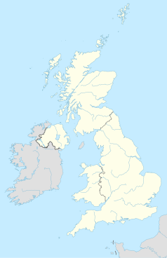
Położenie na mapie Wielkiej Brytanii
Mapa konturowa Wielkiej Brytanii, po prawej znajduje się punkt z opisem „Kelleythorpe”
Położenie na mapie Anglii
Mapa konturowa Anglii, po prawej nieco u góry znajduje się punkt z opisem „Kelleythorpe”
Ziemia53°59′38″N 0°27′31″W/53,993889 -0,458611

Kelleythorpeosada w Anglii, w hrabstwie East Riding of Yorkshire. Leży 29 km na północ od miasta Hull i 277 km na północ od Londynu[1].

Przypisy

[edytuj | edytuj kod]
  1. Kelleythorpe na mapie. getamap.ordnancesurvey.co.uk. [dostęp 2010-11-27]. (ang.).
pFad - Phonifier reborn

Pfad - The Proxy pFad of © 2024 Garber Painting. All rights reserved.

Note: This service is not intended for secure transactions such as banking, social media, email, or purchasing. Use at your own risk. We assume no liability whatsoever for broken pages.


Alternative Proxies:

Alternative Proxy

pFad Proxy

pFad v3 Proxy

pFad v4 Proxy