Akyaka, Kars
Appearance
Akyaka | |
|---|---|
| Coordinates: 40°44′40″N 43°37′30″E / 40.74444°N 43.62500°E | |
| Kintra | |
| Region | Eastren Anatolie |
| Province | Kars |
| Govrenment | |
| • Mayor | Turgut Turan (DP) |
| Area | |
| • Total | 550 km2 (210 sq mi) |
| • Density | 26.6/km2 (69/sq mi) |
| Time zone | UTC+2 (EET) |
| • Summer (DST) | UTC+3 (EEST) |
| Postal code | 36xxx |
| Area code(s) | +(90)474 |
| Website | www.yerelnet.org.tr |

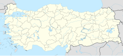
Akyaka is a destrict o Kars Province in eastren Turkey, an the name o the sma toun that is the destrict's admeenistrative caipital. It is locatit at Armenie border o Turkey. The settlement wis cried Şuregel till 1922 an Kızılçakçak atween 1922-1961. It wis a destrict atween 1922-1926 an aw, an a tounship in Arpaçay destrict atween 1926-1988. Akyaka municipality wis established in 1972. The population is 2,273 as o 2010.
Akyaka is a border checkpoint on the railwey intae Armenie, which is currently closed. The route D.060 frae Kars runs next tae the railwey leadin tae the border.[1]
References
[eedit | eedit soorce]- ↑ Kanbolat, Hasan (9 October 2007). "Ermenistan'ın Türkiye ile Sorunu Nedir, Sınır Kapısı Açılmalı mıdır?" (in Turkish). Avrasya Bir Vakfı-Avrasya Stratejik Araştırmalar Merkezi. Archived frae the original on 20 Mey 2007. Retrieved 15 Mairch 2009.


