Ingeleben
Izgled
| Ingeleben Ingeleben | |
|---|---|
 Grb | |
| Osnovni podaci | |
| Država | |
| Gradonačelnik | Sonja Spindler |
| Savezna država | Donja Saksonija |
| Stanovništvo | |
| Stanovništvo | 416[1] |
| Gustina stanovništva | 46 st./km² |
| Geografija | |
| Koordinate | 52°06′27″N 10°52′28″E / 52.1075°N 10.87444°E |
| Vremenska zona | UTC+1, ljeti UTC+2 |
| Nadmorska visina | 115 m |
| Površina | 9,1 km² |
| Ostali podaci | |
| Poštanski kod | 38385 |
| Pozivni broj | 05354 |
| Registarska oznaka | HE |
| Web-stranica | www.samtgemeinde heeseberg.de |
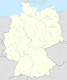
Ingeleben (nem. Ingeleben) je opština u njemačkoj saveznoj državi Donja Saksonija. Jedno je od 26 opštinskih središta okruga Helmštet. Prema procjeni iz 2010. u opštini je živjelo 416 stanovnika. Posjeduje regionalnu šifru (AGS) 3154011.

Ingeleben se nalazi u saveznoj državi Donja Saksonija u okrugu Helmštet. Opština se nalazi na nadmorskoj visini od 115 metara. Površina opštine iznosi 9,1 km². U samom mjestu je, prema procjeni iz 2010. godine, živjelo 416 stanovnika. Prosječna gustina stanovništva iznosi 46 stanovnika/km².
- ↑ Broj stanovnika po njem. Saveznom zavodu za statistiku. Stanje 30. 6. 2010.
- Berger, Dieter (1999). Geographische Namen in Deutschland. Bibliographisches Institut. ISBN 3411062525.
- Fulbrook, Mary (1991). A Concise History of Germany. Cambridge University Press. ISBN 978-0-521-36836-0.
- Gareth, Shaw (2011). Urban Historical Geography: Recent Progress in Britain and Germany (Cambridge Studies in Historical Geography) (Reprint edition izd.). Cambridge University Press. ISBN 0521189748.
- Home, William R.; Pavlovic, Zoran (2007). Germany (Modern World Nations) (2 ed. izd.). Chelsea House Pub. ISBN 0791095126.
- Hamm, Ingrid; Werding, Martin; Seitz, Helmut (3540681353). Demographic Change in Germany (8. izd.). New York: Springer-Verlag. ISBN 2007.
- Berghahn, V. R. (2004). Modern Germany: Society, Economy and Politics in the Twentieth Century (2. izd.). Cambridge University Press. ISBN 0521347483.
- Jähnig, Bernhart; Biewer, Ludwig (1991). Kleiner Atlas zur deutschen Territorialgeschichte (2. izd.). Bonn: Kulturstiftung der Deutschen Vertriebenen. ISBN 3885570963.
- Dornbusch, Joachim; Aner, Ekkehard (1997). Grosser Atlas zur Weltgeschichte. Braunschweig: Westermann. ISBN 3075095206.
- Zvanični sajt opštine (de)
- Nem. Savezni zavod za statistiku (de)
- Stalna konferencija gradova i opština (de)
- KommOn - Informacioni sistem gradova, opština i okruga. (de)


