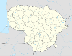
Kretinga
Appearance
Kretinga | |
|---|---|
City | |
 Aerial view of Kretinga | |
| Coordinates: 55°53′24″N 21°14′32″E / 55.89000°N 21.24222°E | |
| Country | |
| Ethnographic region | Samogitia |
| County | |
| Municipality | Kretinga district municipality |
| Eldership | Kretinga town eldership |
| Capital of | Kretinga district municipality Kretinga town eldership Kretinga rural eldership |
| First mentioned | 1253 |
| Granted municipal rights | 1607 |
| Population (2021) | |
| • Total | 17,249[1] |
| Time zone | UTC+2 (EET) |
| • Summer (DST) | UTC+3 (EEST) |
Kretinga is one of the oldest known towns in Lithuania. It is first recorded in 1253. It is in Klaipėda County. It is the capital of the Kretinga district.
The river Akmena winds through the city from north to south , dividing the city into two parts, which are connected by 4 bridges.
References
[change | change source]- ↑ "GYVENTOJAI GYVENAMOSIOSE VIETOVĖSE". Osp.stat.gov.lt. Archived from the original (XLSX) on 7 March 2022. Retrieved 16 July 2022.


