Oneida County, Idaho
Appearance
Oneida County | |
|---|---|
 Oneida County Courthouse in Malad City | |
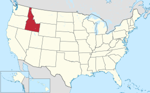
 Location within the U.S. state of Idaho | |
 Idaho's location within the U.S. | |
| Coordinates: 42°13′N 112°31′W / 42.21°N 112.52°W | |
| Country | |
| State | |
| Founded | January 22, 1864 |
| Named for | Oneida Lake, New York |
| Seat | Malad City |
| Largest city | Malad City |
| Area | |
| • Total | 1,202 sq mi (3,110 km2) |
| • Land | 1,200 sq mi (3,000 km2) |
| • Water | 1.5 sq mi (4 km2) 0.1% |
| Population (2020) | |
| • Total | 4,564 |
| • Density | 3.8/sq mi (1.5/km2) |
| Time zone | UTC−7 (Mountain) |
| • Summer (DST) | UTC−6 (MDT) |
| Congressional district | 2nd |
| Website | oneidacountyid |
Oneida County is a county in the U.S. state of Idaho. As of the 2020 census, 4,564 people lived there.[1] The county seat and largest city is Malad City.[2] Most of the county's population lives in Malad City and the surrounding Malad Valley.
History
[change | change source]Oneida County was founded on January 22, 1864 and named for Oneida Lake, New York.
Geography
[change | change source]According to the U.S. Census Bureau, the county has a total area of 1,202 square miles (3,110 km2), of which 1,200 square miles (3,100 km2) is land and 1.5 square miles (3.9 km2) (0.1%) is water.[3]
Bordering counties
[change | change source]- Power County – north
- Bannock County – northeast
- Franklin County – east
- Cache County, Utah – southeast
- Box Elder County, Utah – south
- Cassia County – west
Communities
[change | change source]City
[change | change source]Unincorporated communities
[change | change source]- Cherry Creek
- Holbrook
- Pleasantview
- Samaria
- Stone
- Woodruff
Ghost town
[change | change source]- Black Pine
References
[change | change source]- ↑ "QuickFacts: Oneida County, Idaho". United States Census Bureau. Retrieved September 25, 2023.
- ↑ "Find a County". National Association of Counties. Retrieved 2011-06-07.
- ↑ "US Gazetteer files: 2010, 2000, and 1990". United States Census Bureau. 2011-02-12. Retrieved 2011-04-23.
