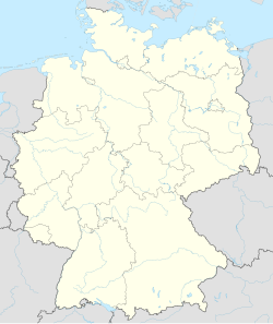
Rheine
Rheine | |
|---|---|
 | |
| Coordinates: 52°17′N 7°26′E / 52.283°N 7.433°E | |
| Country | Germany |
| State | North Rhine-Westphalia |
| Admin. region | Münster |
| District | Steinfurt |
| Government | |
| • Mayor | Angelika Kordfelder (SPD) |
| Area | |
| • Total | 145 km2 (56 sq mi) |
| Elevation | 35 m (115 ft) |
| Population (2022-12-31)[1] | |
| • Total | 77,893 |
| • Density | 540/km2 (1,400/sq mi) |
| Time zone | UTC+01:00 (CET) |
| • Summer (DST) | UTC+02:00 (CEST) |
| Postal codes | 48429-48432 |
| Dialling codes | 05971, 05975, 05459 |
| Vehicle registration | ST, BF, TE |
| Website | www |
Rheine is a city in the district of Steinfurt, in North Rhine-Westphalia, Germany. It is the biggest city in the district.
Geography
[change | change source]Rheine is on the river Ems, about 40 kilometres (25 miles) north of Münster, about 45 kilometres (28 miles) west of Osnabrück and 45 kilometres (28 miles) east of Enschede (Netherlands).
Division of the town
[change | change source]Rheine consists of 15 districts:
|
|
|
Neighbouring municipalities
[change | change source]History
[change | change source]Although a lot of people have lived in the area around the city since prehistorical times, Rheine was first mentioned in a document signed by Louis the Pious only in 838. On 15 August 1327 it got its town charter from Louis II, Bishop of Münster.
The settlement was founded by reason of two old merchant roads crossing nearby, as well as a ford crossing the river Ems. Frankish soldiers secured this strategic point by a barrack yard at first. Later a church and more buildings were added to this outpost.
In the end of Thirty Years' War the city burned down almost completely. Swedish and Hessian troops besieged imperial soldiers who entrenched themselves in Rheine. On 20th/21st September and 19th October 1647 glowing cannonballs set fire to the city, 365 houses got razed.
During the industrialisation textile industry prospered. It continued to be an important economical factor until the second half of the 20th century. Today engineering industries and services form the largest part of economy in Rheine.
Twin towns
[change | change source] Borne (Netherlands) -- since 1983
 Bernburg (Saale) (Saxony-Anhalt, Germany) -- since 1990
 Leiria (Portugal) -- since 1996
 Trakai (Lithuania) -- since 1996
References
[change | change source]Other websites
[change | change source]![]() Media related to Rheine at Wikimedia Commons
Media related to Rheine at Wikimedia Commons
- Official site
- Association for Rheine's twin towns Archived 2013-06-24 at the Wayback Machine


