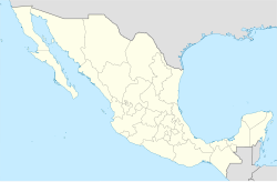
Tijuana
Appearance
Tijuana | |
|---|---|
| Ciudad de Tijuana City of Tijuana | |
 Zona Río, the main business district | |
| Nickname(s): T.J. Gateway to Mexico A Heart Between Two Seas | |
| Coordinates: 32°31′30″N 117°02′0″W / 32.52500°N 117.03333°W | |
| Country | Mexico |
| State | Baja California |
| Municipality | Tijuana |
| Founded | July 11, 1889 |
| Government | |
| • Type | Ayuntamiento |
| • Municipal President | Carlos Bustamante Anchondo |
| Area | |
| • City | 637 km2 (246 sq mi) |
| • Metro | 1,392.5 km2 (537.9 sq mi) |
| Elevation | 20 m (65 ft) |
| Population (2010 Census) | |
| • City | 1,300,983 |
| • Density | 2,000/km2 (5,300/sq mi) |
| • Metro | 1,650,351 |
| • Metro density | 1,200/km2 (3,100/sq mi) |
| [1] | |
| Demonym | Tijuanan |
| Time zone | UTC−8 (PST) |
| • Summer (DST) | UTC−7 (PDT) |
| Postal code | 22000, 22200, 22127, 22440, 22444, 22650 |
| Area code | 664 |
| Website | http://www.tijuana.gob.mx |
Tijuana (/tiːəˈwɑːnə/ tee-ə-WAH-nə or /tiːˈwɑːnə/; Spanish: [tiˈxwana]) is a city in Mexico. It is in the north of the country and across the border from California in the United States. It is the largest city in Baja California. Tijuana is well known destination for US Tourists. Tijuana is the municipal seat for the Tijuana municipality.
Sources
[change | change source]- ↑ Link to 2010 Mexican Census Info INEGI: Instituto Nacional de Estadística, Geografía e Informática.

