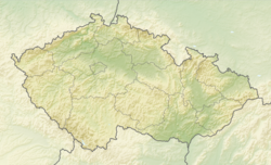
Vlachovice (Žďár nad Sázavou )
Qiyofa
Vlachovice | |
|---|---|
 Main intersection in Vlachovice | |
| Koordinatalari: 49°7′26″N 17°56′24″E / 49.12389°N 17.94000°E | |
| Country |
|
| Region | Zlín |
| District | Zlín |
| First mentioned | 1261 |
| Hudud | |
| • Umumiy | 22,38 km2 (9 sq mi) |
| Balandligi | 339 m (1 100 ft) |
| Aholisi (2022-01-01)[1] | |
| • Umumiy | 1 472 |
| • Zichligi | 66/km2 (170/sq mi) |
| Vaqt mintaqasi | UTC+1 (CET) |
| • Yoz (DST) | UTC+2 (CEST) |
| Postal code |
763 24 |
| Veb-sayt | vlachovice.cz |
Vlachovice Chexiya respublikasida joylashgan aholi punkti. Uning 1472 ga yaqin aholisi bor.
Manbalar
[tahrir | manbasini tahrirlash]- ↑ „Population of Municipalities – 1 January 2022“. Czech Statistical Office (2022-yil 29-aprel).


