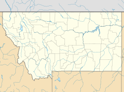
圖多特 (蒙大拿州)
外观
| 圖多特 Twodot | |
|---|---|
| 普查規定居民點 | |
 | |
| 坐标:46°25′28″N 110°04′23″W / 46.42444°N 110.07306°W | |
| 國家 | 美国 |
| 州份 | 蒙大拿州 |
| 縣 | 惠特蘭縣 |
| 面积 | |
| • 总计 | 2.12 平方公里(0.82 平方英里) |
| • 陸地 | 2.12 平方公里(0.82 平方英里) |
| • 水域 | 0.00 平方公里(0.00 平方英里) |
| 海拔 | 1,354 公尺(4,442 英尺) |
| 人口(2020)[1] | |
| • 總計 | 26人 |
| • 密度 | 12.3人/平方公里(31.8人/平方英里) |
| 时区 | MST(UTC-7) |
| • 夏时制 | MDT(UTC-6) |
| 郵區編號 | 59085 |
| 電話區號 | 406 |
| GNIS ID | 2804320[2] |
圖多特(英語:Twodot)是位於美國蒙大拿州惠特蘭縣的普查規定居民點。
歷史
[编辑]圖多特的郵局自1900年營運至今。[3]
人口
[编辑]根據2020年美國人口普查的數據,圖多特的面積為2.12平方千米,皆為陸地。當地共有人口26人,而人口密度為每平方千米12.26人。[1]
參考文獻
[编辑]- ^ 1.0 1.1 2020 U.S. Gazetteer Files. United States Census Bureau. [2022-05-21]. (原始内容存档于2022-05-28).
- ^ Twodot. Geographic Names Information System. United States Geological Survey.
- ^ Wheatland County. Jim Forte Postal History. [2024-07-08].
| 这是一篇關於蒙大拿州的地理小作品。您可以通过编辑或修订扩充其内容。 |

