跳转到内容

西经70度线

本页使用了标题或全文手工转换
维基百科,自由的百科全书
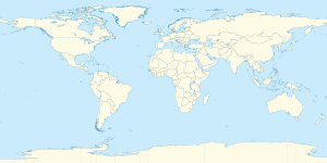
西经70度线在Earth的位置
70°
西经70度线
使用下方服务在地图上显示所有坐标: OpenStreetMap

西經70度線本初子午線向西70度的經線,是為西經70°。此線經線由北極點起穿過北冰洋北美洲大西洋加勒比海南美洲太平洋南冰洋以及南極洲直到南極點。此段半圓路徑長20,003,932公里(12,429,867英里),於赤道與本初子午線距7,792公里(4,842英里)遠。[1][2]

西經70度線與東經110度線形成一個大圓

界線所經

[编辑]

從北極點至南極點,西經70度線依次穿過:

坐標 國家、領土或海洋 注腳
90°0′N 70°0′W / 90.000°N 70.000°W / 90.000; -70.000 (Arctic Ocean) 北冰洋
83°7′N 70°0′W / 83.117°N 70.000°W / 83.117; -70.000 (Canada)  加拿大 努納福特地區 — 穿越埃爾斯米爾島
80°14′N 70°0′W / 80.233°N 70.000°W / 80.233; -70.000 (Nares Strait) 內爾斯海峽
78°47′N 70°0′W / 78.783°N 70.000°W / 78.783; -70.000 (Greenland)  格陵兰 穿越格陵蘭本土、森德爾斯島英语Saunders Island, Greenland伍爾斯滕霍姆島英语Wolstenholme Island
76°24′N 70°0′W / 76.400°N 70.000°W / 76.400; -70.000 (Baffin Bay) 巴芬灣
70°51′N 70°0′W / 70.850°N 70.000°W / 70.850; -70.000 (Canada)  加拿大 努納福特地區 — 穿越巴芬島
62°45′N 70°0′W / 62.750°N 70.000°W / 62.750; -70.000 (Hudson Strait) 哈得遜海峽
62°34′N 70°0′W / 62.567°N 70.000°W / 62.567; -70.000 (Canada)  加拿大 努納福特地區 — 穿越高崖島英语High Bluff Island
62°33′N 70°0′W / 62.550°N 70.000°W / 62.550; -70.000 (Hudson Strait) 哈得遜海峽
61°1′N 70°0′W / 61.017°N 70.000°W / 61.017; -70.000 (Canada)  加拿大 努納福特地區 — 穿越戴安娜島英语Diana Island
60°57′N 70°0′W / 60.950°N 70.000°W / 60.950; -70.000 (Diana Bay) 戴安娜灣英语Diana Bay
60°50′N 70°0′W / 60.833°N 70.000°W / 60.833; -70.000 (Canada)  加拿大 魁北克
47°42′N 70°0′W / 47.700°N 70.000°W / 47.700; -70.000 (Saint Lawrence River) 聖羅倫斯河
47°30′N 70°0′W / 47.500°N 70.000°W / 47.500; -70.000 (Canada)  加拿大 魁北克
46°40′N 70°0′W / 46.667°N 70.000°W / 46.667; -70.000 (United States)  美国 緬因州
43°43′N 70°0′W / 43.717°N 70.000°W / 43.717; -70.000 (Atlantic Ocean) 大西洋 緬因灣
41°58′N 70°0′W / 41.967°N 70.000°W / 41.967; -70.000 (United States)  美国 麻薩諸塞州 — 穿越鱈魚角莫諾莫伊島英语Monomoy Island
41°33′N 70°0′W / 41.550°N 70.000°W / 41.550; -70.000 (Atlantic Ocean) 大西洋 南塔克特峽灣英语Nantucket Sound
41°19′N 70°0′W / 41.317°N 70.000°W / 41.317; -70.000 (United States)  美国 麻薩諸塞州 — 穿越南塔克特
41°14′N 70°0′W / 41.233°N 70.000°W / 41.233; -70.000 (Atlantic Ocean) 大西洋
19°41′N 70°0′W / 19.683°N 70.000°W / 19.683; -70.000 (Dominican Republic)  多米尼加 伊斯帕尼奧拉島 — 從聖多明哥西方掠過。(18°29′N 69°54′W / 18.483°N 69.900°W / 18.483; -69.900 (Santo Domingo)
18°25′N 70°0′W / 18.417°N 70.000°W / 18.417; -70.000 (Caribbean Sea) 加勒比海
12°35′N 70°0′W / 12.583°N 70.000°W / 12.583; -70.000 (Aruba)  阿鲁巴
12°28′N 70°0′W / 12.467°N 70.000°W / 12.467; -70.000 (Caribbean Sea) 加勒比海
12°11′N 70°0′W / 12.183°N 70.000°W / 12.183; -70.000 (Venezuela)  委內瑞拉
6°53′N 70°0′W / 6.883°N 70.000°W / 6.883; -70.000 (Colombia)  哥伦比亚
0°34′N 70°0′W / 0.567°N 70.000°W / 0.567; -70.000 (Brazil)  巴西 亞馬遜州
0°12′S 70°0′W / 0.200°S 70.000°W / -0.200; -70.000 (Colombia)  哥伦比亚
4°10′S 70°0′W / 4.167°S 70.000°W / -4.167; -70.000 (Peru)  秘魯 洛雷托大區 — 約16公里。
4°19′S 70°0′W / 4.317°S 70.000°W / -4.317; -70.000 (Brazil)  巴西 亞馬遜州
阿克雷州 — 從8°20′S 70°0′W / 8.333°S 70.000°W / -8.333; -70.000 (Acre)穿越。
10°58′S 70°0′W / 10.967°S 70.000°W / -10.967; -70.000 (Peru)  秘魯 馬德雷德迪奧斯大區
普諾大區 — 從13°9′S 70°0′W / 13.150°S 70.000°W / -13.150; -70.000 (Puno)穿越。
塔克納大區 — 從17°7′S 70°0′W / 17.117°S 70.000°W / -17.117; -70.000 (Tacna)穿越。
18°16′S 70°0′W / 18.267°S 70.000°W / -18.267; -70.000 (Chile)  智利
29°19′S 70°0′W / 29.317°S 70.000°W / -29.317; -70.000 (Argentina)  阿根廷 約8公里。
29°24′S 70°0′W / 29.400°S 70.000°W / -29.400; -70.000 (Chile)  智利
30°23′S 70°0′W / 30.383°S 70.000°W / -30.383; -70.000 (Argentina)  阿根廷
32°52′S 70°0′W / 32.867°S 70.000°W / -32.867; -70.000 (Chile)  智利 約8公里。
32°56′S 70°0′W / 32.933°S 70.000°W / -32.933; -70.000 (Argentina)  阿根廷
33°16′S 70°0′W / 33.267°S 70.000°W / -33.267; -70.000 (Chile)  智利
34°17′S 70°0′W / 34.283°S 70.000°W / -34.283; -70.000 (Argentina)  阿根廷
52°0′S 70°0′W / 52.000°S 70.000°W / -52.000; -70.000 (Chile)  智利
52°33′S 70°0′W / 52.550°S 70.000°W / -52.550; -70.000 (Straits of Magellan) 麥哲倫海峽
52°50′S 70°0′W / 52.833°S 70.000°W / -52.833; -70.000 (Chile)  智利 穿越大火地島湯普森島英语Thompson Island (Chile)沃特曼島英语Waterman Island奧斯特島
55°22′S 70°0′W / 55.367°S 70.000°W / -55.367; -70.000 (Pacific Ocean) 太平洋
60°0′S 70°0′W / 60.000°S 70.000°W / -60.000; -70.000 (Southern Ocean) 南冰洋
69°17′S 70°0′W / 69.283°S 70.000°W / -69.283; -70.000 (Antarctica) 南極洲 亞歷山大一世島與南極本土 —  阿根廷 智利 英国共同主張的南極領地

參見

[编辑]

參考來源

[编辑]
  1. ^ T. Vincenty. Direct and Inverse Solutions of Geodesics on the Ellipsoid with application of nested equation (PDF). 1975-04 [2018-12-16]. (原始内容存档 (PDF)于2013-01-28) (英语). 
  2. ^ Vincenty formula for distance between two Latitude/Longitude points. Movable type scripts. [2017-05-17]. (原始内容存档于2013-01-28) (英语). 
pFad - Phonifier reborn

Pfad - The Proxy pFad of © 2024 Garber Painting. All rights reserved.

Note: This service is not intended for secure transactions such as banking, social media, email, or purchasing. Use at your own risk. We assume no liability whatsoever for broken pages.


Alternative Proxies:

Alternative Proxy

pFad Proxy

pFad v3 Proxy

pFad v4 Proxy