Benrose
Tools
Actions
General
Print/export
In other projects
Appearance
From Wikipedia, the free encyclopedia
Place in Gauteng, South Africa
Benrose | |
|---|---|
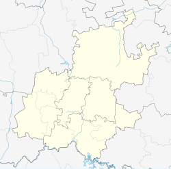
| Coordinates: 26°12′39″S 28°4′54″E / 26.21083°S 28.08167°E / -26.21083; 28.08167 | |
| Country | South Africa |
| Province | Gauteng |
| Municipality | City of Johannesburg |
| Main Place | Johannesburg |
| Established | 1952 |
| Area | |
| • Total | 0.74 km2 (0.29 sq mi) |
| Population (2011)[1] | |
| • Total | 23 |
| • Density | 31/km2 (80/sq mi) |
| Racial makeup (2011) | |
| • Black African | 21.74% |
| • Indian/Asian | 13.04% |
| • White | 65.22% |
| First languages (2011) | |
| • English | 73.91% |
| • Afrikaans | 17.39% |
| • Tswana | 8.7% |
| Time zone | UTC+2 (SAST) |
| Postal code (street) | 2094 |
| PO box | 2011 |
Benrose is a suburb of Johannesburg, South Africa. Slightly south of the Johannesburg CBD, it is next door to Jeppestown and Belgravia. It is light industry and commercial suburb. It is located in Region F of the City of Johannesburg Metropolitan Municipality.
History
[edit]The suburb is situated on part of an old Witwatersrand farm called Doornfontein.[2] The region of Benrose was named by the property developer Robert Horowitz, whose mother's name was Rose and who had been murdered during The Holocaust.[2] It means "son of Rose" in Hebrew. The suburb was proclaimed in June 1952.[2]
References
[edit]- ^ a b c d "Sub Place Benrose". Census 2011.
- ^ a b c Raper, Peter E.; Moller, Lucie A.; du Plessis, Theodorus L. (2014). Dictionary of Southern African Place Names. Jonathan Ball Publishers. p. 1412. ISBN 9781868425501.
Retrieved from "https://en.wikipedia.org/w/index.php?title=Benrose&oldid=1246187612"

