Buerton, Cheshire West and Chester
Appearance
| Buerton | |
|---|---|
 Woodhouse Farm, Buerton | |
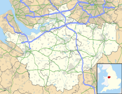
Location within Cheshire | |
| Population | 22 (2001) |
| OS grid reference | SJ424604 |
| Civil parish | |
| Unitary authority | |
| Ceremonial county | |
| Region | |
| Country | England |
| Sovereign state | United Kingdom |
| Post town | CHESTER |
| Postcode district | CH3 |
| Dialling code | 01244 |
| Police | Cheshire |
| Fire | Cheshire |
| Ambulance | North West |
| UK Parliament | |
Buerton is a former civil parish, now in the parish of Aldford and Saighton, in the unitary authority area of Cheshire West and Chester and the ceremonial county of Cheshire, England.[1] According to the 2001 census it had a population of 22. Buerton was formerly a chapelry in the parish of St Oswald,[2] in 1866 Buerton became a separate civil parish,[3] on 1 April 2015 the parish was abolished to form "Aldford and Saighton".[4] From 1974 to 2009 it was in Chester district.
See also
[edit]References
[edit]- ^ Ordnance Survey: Landranger map sheet 118 Stoke-on-Trent & Macclesfield (Map). Ordnance Survey. 2012. ISBN 9780319229064.
- ^ "History of Buerton, in Chester and Cheshire". A Vision of Britain through Time. Retrieved 18 June 2024.
- ^ "Relationships and changes Buerton Tn/CP through time". A Vision of Britain through Time. Retrieved 18 June 2024.
- ^ "Cheshire West and Chester Registration District". UKBMD. Retrieved 18 June 2024.
Wikimedia Commons has media related to Buerton, Cheshire West and Chester.
