Lower Kinnerton
| Lower Kinnerton | |
|---|---|
 Bridge Farm, Lower Kinnerton, at the Wales-England border | |
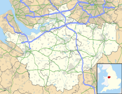
Location within Cheshire | |
| Population | 136 (2011 census) |
| OS grid reference | SJ338621 |
| Civil parish | |
| Unitary authority | |
| Ceremonial county | |
| Region | |
| Country | England |
| Sovereign state | United Kingdom |
| Post town | CHESTER |
| Postcode district | CH4 |
| Dialling code | 01244 |
| Police | Cheshire |
| Fire | Cheshire |
| Ambulance | North West |
| UK Parliament | |
Lower Kinnerton is a village and former civil parish, now in the parish of Dodleston, in the unitary authority of Cheshire West and Chester and the ceremonial county of Cheshire, England, close to the England–Wales border. The neighbouring village of Higher Kinnerton is across the border in Flintshire. Lower Kinnerton is south of Broughton and to the north west of the village of Dodleston. It is a small agricultural community, which is also home to a local kennel and cattery business.
The population was recorded at 97 in 1801, 94 in 1851, 127 in 1901 and 142 in 1951.[1] In the 2001 census it had a population of 119,[2] increasing to 136 at the 2011 census.[3]
Lower Kinnerton Hall (also known as Bridge Farm Farmhouse) was built in 1685, using brown brick with stone dressings and with a slated roof. Attached to the building is a shippon (cattle-shed) dating from the 18th century. Lower Kinnerton Hall is a designated Grade II listed building.[4]
Governance
[edit]Lower Kinnerton was formerly a township in the parish of Doddleston,[5] in 1866 Lower Kinnerton became a civil parish,[6] on 1 April 2015 the parish was abolished and merged with Doddleston.[1][7]
See also
[edit]References
[edit]- ^ a b "Lower Kinnerton". GENUKI UK & Ireland Genealogy. Retrieved 22 April 2018.
- ^ UK Census (2001). "Local Area Report – Lower Kinnerton Parish (13UB077)". Nomis. Office for National Statistics. Retrieved 2 July 2021.
- ^ UK Census (2011). "Local Area Report – Lower Kinnerton Parish (E04011134)". Nomis. Office for National Statistics. Retrieved 2 July 2021.
- ^ Historic England. "Bridge Farm Farmhouse and attached shippon (1136521)". National Heritage List for England. Retrieved 2 July 2021.
- ^ "History of Lower Kinnerton, in Chester and Cheshire". A Vision of Britain through Time. Retrieved 1 September 2023.
- ^ "Relationships and changes Lower Kinnerton CP/Tn through time". A Vision of Britain through Time. Retrieved 1 September 2023.
- ^ "Cheshire West and Chester Registration District". UKBMD. Retrieved 1 September 2023.
External links
[edit]![]() Media related to Lower Kinnerton at Wikimedia Commons
Media related to Lower Kinnerton at Wikimedia Commons
