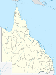
Hodgson Vale, Queensland
| Hodgson Vale Toowoomba, Queensland | |||||||||||||||
|---|---|---|---|---|---|---|---|---|---|---|---|---|---|---|---|
 | |||||||||||||||
| Coordinates | 27°39′55″S 151°57′04″E / 27.6652°S 151.9511°E | ||||||||||||||
| Population | 1,444 (2021 census)[1] | ||||||||||||||
| • Density | 55.97/km2 (145.0/sq mi) | ||||||||||||||
| Postcode(s) | 4352 | ||||||||||||||
| Area | 25.8 km2 (10.0 sq mi) | ||||||||||||||
| Time zone | AEST (UTC+10:00) | ||||||||||||||
| Location |
| ||||||||||||||
| LGA(s) | Toowoomba Region | ||||||||||||||
| State electorate(s) | Condamine | ||||||||||||||
| Federal division(s) | Groom | ||||||||||||||
| |||||||||||||||
Hodgson Vale is a rural locality in the Toowoomba Region, Queensland, Australia.[2] In the 2021 census, Hodgson Vale had a population of 1,444 people.[1]
Geography
[edit]Hodgson Vale is 12 kilometres (7 mi) south of the city centre via New England Highway. The highway passes through the locality from the north (Top Camp) to the west (Vale View/Cambooya).[3]
Hodgson Creek rises just to the north (Top Camp) and flows through the locality to the south-west (Cambooya). It eventually becomes a tributary of the Condamine River (part of the Murray-Darling basin) at North Branch.[3][4]
History
[edit]
The locality is believed to be named for Sir Arthur Hodgson, a pioneer and member for the Legislative Assembly seat of Warrego in 1868–1869.[5] In July 1840 he selected the Eton Vale pastoral run (the second pastoral run selected in present-day Queensland). The Eton Vale homestead was beside Hodgson Creek in the present day locality of Cambooya.[4]
Hodgsons Vale Provisional School opened on 14 June 1906. It became Hodgsons Vale State School on 1 January 1909. It closed in 1960.[6] It was at 161 Hodgson Vale Road (27°39′53″S 151°56′56″E / 27.66479°S 151.94882°E).[7][3]
Demographics
[edit]In the 2016 census, Hodgson Vale had a population of 1,379 people.[8]
In the 2021 census, Hodgson Vale had a population of 1,444 people.[1]
Education
[edit]There are no schools in Hodgson Vale. The nearest government primary schools are in neighbouring Vale View and Ramsay. The nearest secondary schools are Centenary Heights State High School in Centenary Heights and Harristown State High School in Harristown, both in Toowoomba.[3]
References
[edit]- ^ a b c Australian Bureau of Statistics (28 June 2022). "Hodgson Vale (SAL)". 2021 Census QuickStats. Retrieved 28 February 2023.
- ^ "Hodgson Vale – locality in Toowoomba Region (entry 47971)". Queensland Place Names. Queensland Government. Retrieved 7 March 2022.
- ^ a b c d "Queensland Globe". State of Queensland. Retrieved 23 August 2023.
- ^ a b "Hodgson Creek – watercourse in the Toowoomba Region (entry 15971)". Queensland Place Names. Queensland Government. Retrieved 24 April 2019.
- ^ "Hodgson Vale (entry 47971)". Queensland Place Names. Queensland Government. Retrieved 28 August 2015.
- ^ Queensland Family History Society (2010), Queensland schools past and present (Version 1.01 ed.), Queensland Family History Society, ISBN 978-1-921171-26-0
- ^ "Parish of Ramsay" (Map). Queensland Government. 1950. Retrieved 23 August 2023.
- ^ Australian Bureau of Statistics (27 June 2017). "Hodgson Vale (SSC)". 2016 Census QuickStats. Retrieved 20 October 2018.
Further reading
[edit]- Ramsay State School 125th celebrations 1881 - 2006 : including recollections and rolls from the now changed schools of Eton Vale, Top Camp, Preston, Hodgson's Vale, Ramsay State School, 2006
External links
[edit]- "Top Camp and Hodgson Vale". Queensland Places. University of Queensland.
