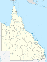
Meringandan West, Queensland
| Meringandan West Queensland | |||||||||||||||
|---|---|---|---|---|---|---|---|---|---|---|---|---|---|---|---|
 Clifford Street, 2014 | |||||||||||||||
| Coordinates | 27°25′00″S 151°53′32″E / 27.4166°S 151.8922°E | ||||||||||||||
| Population | 2,488 (2021 census)[1] | ||||||||||||||
| • Density | 149.9/km2 (388.2/sq mi) | ||||||||||||||
| Postcode(s) | 4352 | ||||||||||||||
| Area | 16.6 km2 (6.4 sq mi) | ||||||||||||||
| Time zone | AEST (UTC+10:00) | ||||||||||||||
| Location |
| ||||||||||||||
| LGA(s) | Toowoomba Region | ||||||||||||||
| State electorate(s) | Condamine | ||||||||||||||
| Federal division(s) | Groom | ||||||||||||||
| |||||||||||||||
Meringandan West is a rural locality in the Toowoomba Region, Queensland, Australia.[2] In the 2021 census, Meringandan West had a population of 2,488 people.[1]
Geography
[edit]Meringandan West is on the Darling Downs in southern Queensland. The majority of the eastern boundary is aligned with Meringandan Creek, separating the locality from Meringandan.[3] The creek also formed the boundary between the Shire of Crows Nest and the Shire of Rosalie) with Meringandan West falling under the jurisdiction of the Shire of Rosalie. In 2008, both Meringandan and Meringandan West both came under the jurisdiction of the newly created Toowoomba Region.[2][4]
Mount Muniganeen is in the north-west of the locality (27°24′02″S 151°52′20″E / 27.4006°S 151.8721°E) rising to 613 metres (2,011 ft) above sea level.[5][6]
Central parts of the area have been developed into a residential estate. Meringandan West was part of a local planning scheme developed and adopted by the Toowoomba Region Council in August 2013.[7]
History
[edit]The name Meringandan is taken from the former railway station, which in turn is a Gooneburra word meaning red soil or broken clay.[2]
Meringandan State School opened on 24 January 1876.[8] It was built during 1875 by Jack Maag. Isaac John Thomas was appointed the first head teacher of the school. The enrolment for that year was 80 pupils.[9] It is now within the suburb boundaries of Meringandan West.[10]
The Meringandan Cemetery was surveyed on 13 October 1876. It was operated by local trustees until 2004, when control was passed to the Rosalie Shire Council 2005, and then to the Toowoomba Regional Council in 2008 following local government amalgamations.[11]
Demographics
[edit]In the 2016 census, Meringandan West had a population of 2,211 people.[12]
In the 2021 census, Meringandan West had a population of 2,488 people.[1]
Education
[edit]Meringandan State School is a government primary (Prep-6) school for boys and girls at 10 School Road (27°25′49″S 151°54′18″E / 27.4303°S 151.9050°E).[13][14] In 2017, the school had an enrolment of 240 students with 20 teachers (15 full-time equivalent) and 14 non-teaching staff (8 full-time equivalent).[15]
There are no secondary schools in Meringandan West. The nearest government secondary school is Highfields State Secondary College in Highfields to the south-east.[16]
Facilities
[edit]Lilyvale Oval was once used for an annual rodeo hosted by the P&C of Meringandan State School. The P&C also used to run Christmas Carols in the park, but they were also cancelled for lack of funding. Small church groups still used the park for annual carols nights.[17]
Meringandan Cemetery is a 10-acre (4.0 ha) site on the eastern side of Peters Road (27°25′21″S 151°53′57″E / 27.4225°S 151.8992°E). It is operated by the Toowoomba Regional Council.[11]
There are several scattered parks. The most notable park is Lilyvale Oval, which has an unlit sporting field (cricket pitch), which is used for a radio-controlled model aircraft flying field on occasion by the local inhabitants and visitors also, probably, operates as a flood basic, a playground, a picnic table, and a community shed, as well as a BBQ and toilet block for public use.[citation needed]
Next to this park, is a shed, from which operates the local rural fire brigade.[citation needed]
References
[edit]- ^ a b c Australian Bureau of Statistics (28 June 2022). "Meringandan West (SAL)". 2021 Census QuickStats. Retrieved 28 February 2023.
- ^ a b c "Meringandan West – locality in Toowoomba Region (entry 49183)". Queensland Place Names. Queensland Government. Retrieved 15 November 2023.
- ^ "Queensland Globe". State of Queensland. Retrieved 15 November 2023.
- ^ "Meringandan – locality in Toowoomba Region (entry 49182)". Queensland Place Names. Queensland Government. Retrieved 15 November 2023.
- ^ "Mountain peaks and capes - Queensland". Queensland Open Data. Queensland Government. 12 November 2020. Archived from the original on 25 November 2020. Retrieved 25 November 2020.
- ^ "Mount Muniganeen – mountain in Toowoomba Region (entry 40673)". Queensland Place Names. Queensland Government. Retrieved 25 November 2020.
- ^ "Highfields, Meringandan and Meringandan West Local Plan". Local plans. Toowoomba Regional Council. 22 August 2013. Archived from the original on 27 November 2014. Retrieved 16 November 2014.
- ^ Queensland Family History Society (2010), Queensland schools past and present (Version 1.01 ed.), Queensland Family History Society, ISBN 978-1-921171-26-0
- ^ "History". Meringandan State School. 20 March 2012. Archived from the original on 20 March 2012. Retrieved 15 November 2023.
- ^ "Queensland Globe". State of Queensland. Retrieved 30 December 2021.
- ^ a b "Cemetery locations, open hours and interment options". Toowoomba Region. Retrieved 15 November 2023.
- ^ Australian Bureau of Statistics (27 June 2017). "Meringandan West (SSC)". 2016 Census QuickStats. Retrieved 20 October 2018.
- ^ "State and non-state school details". Queensland Government. 9 July 2018. Archived from the original on 21 November 2018. Retrieved 21 November 2018.
- ^ "Meringandan State School". Meringandan State School. 24 August 2022. Retrieved 15 November 2023.
- ^ "ACARA School Profile 2017". Archived from the original on 22 November 2018. Retrieved 22 November 2018.
- ^ "Layers: Locality; Schools and school catchments". Queensland Globe. Queensland Government. Retrieved 15 November 2023.
- ^ A Meringandan Resident
