L'Alcúdia de Crespins
Appearance
This article needs additional citations for verification. (December 2016) |
L'Alcúdia de Crespins
Alcudia de Crespins | |
|---|---|
| Coordinates: 38°58′15″N 0°35′27″W / 38.97083°N 0.59083°W | |
| Country | |
| Autonomous community | |
| Province | Valencia |
| Comarca | Costera |
| Judicial district | Xàtiva |
| Government | |
| • Alcalde | Javier Sicluna i Lletget |
| Area | |
• Total | 5.20 km2 (2.01 sq mi) |
| Elevation | 160 m (520 ft) |
| Population (2018)[1] | |
• Total | 5,188 |
| • Density | 1,000/km2 (2,600/sq mi) |
| Demonym | Alcudiano/a |
| Time zone | UTC+1 (CET) |
| • Summer (DST) | UTC+2 (CEST) |
| Postal code | 46690 |
| Official language(s) | Valencian |
| Website | Official website |
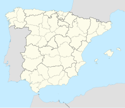
L'Alcúdia de Crespins is a municipality in the comarca of Costera in the Valencian Community, Spain.
History
[edit]L'Alcúdia de Crespins boasts a fascinating history that dates back to the Roman era. Evidence of this can be seen in the archaeological sites and artifacts discovered in the town and its surroundings. One notable site is the Roman villa of Els Munts, where ancient mosaics and ruins have been preserved. This historical heritage provides valuable insights into the town's past and offers visitors an opportunity to connect with the lives of those who came before.
References
[edit]- ^ Municipal Register of Spain 2018. National Statistics Institute.


