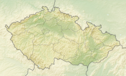
Dobrá (Frýdek-Místek District)
Dobrá | |
|---|---|
 View of Dobrá from the brewery | |
| Coordinates: 49°40′26″N 18°24′50″E / 49.67389°N 18.41389°E | |
| Country | |
| Region | Moravian-Silesian |
| District | Frýdek-Místek |
| First mentioned | 1305 |
| Area | |
• Total | 8.73 km2 (3.37 sq mi) |
| Elevation | 332 m (1,089 ft) |
| Population (2024-01-01)[1] | |
• Total | 3,248 |
| • Density | 370/km2 (960/sq mi) |
| Time zone | UTC+1 (CET) |
| • Summer (DST) | UTC+2 (CEST) |
| Postal code | 739 51 |
| Website | www |
Dobrá (Polish: Dobra, German: Dobrau) is a municipality and village in Frýdek-Místek District in the Moravian-Silesian Region of the Czech Republic. It has about 3,200 inhabitants.
Geography
[edit]Dobrá is located about 3 kilometres (2 mi) east of Frýdek-Místek and 17 km (11 mi) southeast of Ostrava, in the historical region of Cieszyn Silesia. It lies in the Moravian-Silesian Foothills. The highest point is the Dobrá Hill at 385 m (1,263 ft) above sea level. The municipality is situated on the right bank of the Morávka River.
History
[edit]The settlement was first mentioned in a Latin document of Diocese of Wrocław called Liber fundationis episcopatus Vratislaviensis from around 1305 as Dobroczemicza. The creation of the village was a part of a larger settlement campaign taking place in the late 13th century on the territory of what will be later known as Upper Silesia.[2][3]
Politically the village belonged initially to the Duchy of Teschen, formed in 1290 in the process of feudal fragmentation of Poland and was ruled by a local branch of Piast dynasty. In 1327 the duchy became a fee of Kingdom of Bohemia, which after 1526 became part of the Habsburg monarchy.
The village became a seat of a Catholic parish, mentioned in the register of Peter's Pence payment from 1447 among 50 parishes of Teschen deaconry as Dobersey.[4]
In 1573 it was sold as one of 16 villages and the town of Friedeck and formed a state country split from the Duchy of Teschen.[5]
After World War I and fall of Austria-Hungary it became a part of Czechoslovakia. In March 1939 it became a part of Protectorate of Bohemia and Moravia. After World War II it was restored to Czechoslovakia.
Demographics
[edit]
|
|
| ||||||||||||||||||||||||||||||||||||||||||||||||||||||
| Source: Censuses[6][7] | ||||||||||||||||||||||||||||||||||||||||||||||||||||||||
Transport
[edit]The D48 motorway (part of the European route E462) from Frýdek-Místek to Český Těšín passes through the municipality.
Dobrá is located on the railway line from Frýdek-Místek to Cieszyn.[8]
Sights
[edit]
The current late Baroque building of the Church of Saint George dates from 1682–1686. The so-called Russian tower was added in 1816.[2]
The Baroque building of the "U Oráče" restaurant dates from the turn of the 17th and 18th centuries, behind which a Baroque granary from the 18th century has been preserved.[2]
Notable people
[edit]- David Stypka (1979–2021), singer
Twin towns – sister cities
[edit] Buczkowice, Poland
 Mucharz, Poland
 Ochodnica, Slovakia
References
[edit]- ^ "Population of Municipalities – 1 January 2024". Czech Statistical Office. 2024-05-17.
- ^ a b c "Historie obce" (in Czech). Obec Dobrá. Retrieved 2021-01-21.
- ^ Panic, Idzi (2015). Śląsk Cieszyński w średniowieczu (do 1528) [Cieszyn Silesia in Middle Ages (until 1528)] (PDF) (in Polish). Cieszyn: Starostwo Powiatowe w Cieszynie. pp. 297–299. ISBN 978-83-935147-8-6.
- ^ "Registrum denarii sancti Petri in archidiaconatu Opoliensi sub anno domini MCCCCXLVII per dominum Nicolaum Wolff decretorum doctorem, archidiaconum Opoliensem, ex commissione reverendi in Christo patris ac domini Conradi episcopi Wratislaviensis, sedis apostolice collectoris, collecti". Zeitschrift des Vereins für Geschichte und Alterthum Schlesiens (in German). 27. Breslau: H. Markgraf: 361–372. 1893. Archived from the original on 21 September 2013. Retrieved 21 July 2014.
- ^ Panic, Idzi (2011). Śląsk Cieszyński w początkach czasów nowożytnych (1528-1653) [Cieszyn Silesia in the beginnings of Modern Era (1528-1653)] (in Polish). Cieszyn: Starostwo Powiatowe w Cieszynie. p. 224. ISBN 978-83-926929-5-9.
- ^ "Historický lexikon obcí České republiky 1869–2011" (in Czech). Czech Statistical Office. 2015-12-21.
- ^ "Population Census 2021: Population by sex". Public Database. Czech Statistical Office. 2021-03-27.
- ^ "Detail stanice Dobrá u Frýdku-Místku" (in Czech). České dráhy. Retrieved 2023-08-15.
- ^ "Partnerské obce" (in Czech). Obec Dobrá. Retrieved 2020-10-19.


