Pazderna
Pazderna | |
|---|---|
Chapel of Saint John of Nepomuk | |
| Coordinates: 49°42′15″N 18°26′3″E / 49.70417°N 18.43417°E | |
| Country | |
| Region | Moravian-Silesian |
| District | Frýdek-Místek |
| First mentioned | 1573 |
| Area | |
• Total | 3.22 km2 (1.24 sq mi) |
| Elevation | 316 m (1,037 ft) |
| Population (2024-01-01)[1] | |
• Total | 396 |
| • Density | 120/km2 (320/sq mi) |
| Time zone | UTC+1 (CET) |
| • Summer (DST) | UTC+2 (CEST) |
| Postal code | 739 51 |
| Website | www |
Pazderna (Polish: Październa) is a municipality and village in Frýdek-Místek District in the Moravian-Silesian Region of the Czech Republic. It has about 400 inhabitants.
Etymology
[edit]The word pazderna was a designation for the house where flax was drying and shives (in Czech pazdeří) was obtained. The village was probably founded around such a house.[2]
Geography
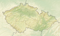
[edit]Pazderna is located about 5 kilometres (3 mi) east of Frýdek-Místek and 15 km (9 mi) southeast of Ostrava. It lies in the historical region of Cieszyn Silesia, in the western part of the Moravian-Silesian Foothills. The Pazderůvka brook flows through the municipality.
History
[edit]The first written mention of Pazderna is from 1573, when it was part of the Frýdek state country and had 14 homesteads. It was probably founded only a few years ago.[2] It was then mentioned as Pazdierna in the document sealing the selling of Frýdek by Stanislav II Pavlovský, Bishop of Olomouc, to Bartholomew von Wrbno.[3] After World War I and fall of Austria-Hungary, it became a part of Czechoslovakia.
Demographics
[edit]
|
|
| ||||||||||||||||||||||||||||||||||||||||||||||||||||||
| Source: Censuses[4][5] | ||||||||||||||||||||||||||||||||||||||||||||||||||||||||
Transport
[edit]There are no railways or major roads passing through the municipality.
Sights
[edit]There are no protected cultural monuments in the municipality.[6] A landmark is the Chapel of Saint John of Nepomuk, built in 1871.[2]
References
[edit]- ^ "Population of Municipalities – 1 January 2024". Czech Statistical Office. 2024-05-17.
- ^ a b c "Historie obce Pazderna" (in Czech). Obec Pazderna. Retrieved 2022-06-30.
- ^ Panic, Idzi (2011). Śląsk Cieszyński w początkach czasów nowożytnych (1528-1653) [Cieszyn Silesia in the beginnings of Modern Era (1528-1653)] (in Polish). Cieszyn: Starostwo Powiatowe w Cieszynie. p. 167. ISBN 978-83-926929-5-9.
- ^ "Historický lexikon obcí České republiky 1869–2011" (in Czech). Czech Statistical Office. 2015-12-21.
- ^ "Population Census 2021: Population by sex". Public Database. Czech Statistical Office. 2021-03-27.
- ^ "Výsledky vyhledávání: Kulturní památky, obec Pazderna". Ústřední seznam kulturních památek (in Czech). National Heritage Institute. Retrieved 2024-07-15.


