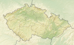
Morávka (Frýdek-Místek District)
Morávka | |
|---|---|
 Lower part of Morávka | |
| Coordinates: 49°35′46″N 18°31′29″E / 49.59611°N 18.52472°E | |
| Country | |
| Region | Moravian-Silesian |
| District | Frýdek-Místek |
| Founded | 1615 |
| Area | |
• Total | 87.29 km2 (33.70 sq mi) |
| Elevation | 520 m (1,710 ft) |
| Population (2024-01-01)[1] | |
• Total | 1,413 |
| • Density | 16/km2 (42/sq mi) |
| Time zone | UTC+1 (CET) |
| • Summer (DST) | UTC+2 (CEST) |
| Postal code | 739 04 |
| Website | www |
Morávka (German: Morawka, Polish: Morawka) is a municipality and village in Frýdek-Místek District in the Moravian-Silesian Region of the Czech Republic. It has about 1,400 inhabitants.
Geography
[edit]Morávka is located about 15 kilometres (9 mi) southeast of Frýdek-Místek and 30 km (19 mi) southeast of Ostrava. It lies in the historical region of Cieszyn Silesia, on the border with Slovakia. The municipality lies in the Moravian-Silesian Beskids. The highest point is the Malý Travný mountain at 1,100 m (3,600 ft) above sea level.
The Morávka River originates here and flows across the entire municipal territory. The Morávka Reservoir was built on the river in the municipality in 1961–1967.[2]
History
[edit]Morávka was established in 1615.[3] It was then a part of the Friedek state country that was split from the Duchy of Teschen in 1573, which was a part of the Kingdom of Bohemia. After World War I and fall of Austria-Hungary, it became a part of Czechoslovakia.
During World War II, the inhabitants of the municipality took part in the anti-Nazi resistance. In December 1944, the Nazis captured the guerrilla group and after interrogation and torture they obtained information about their supporters: 14 people of the village were executed, 10 were deported into a concentration camp.[4]
Demographics
[edit]
|
|
| ||||||||||||||||||||||||||||||||||||||||||||||||||||||
| Source: Censuses[5][6] | ||||||||||||||||||||||||||||||||||||||||||||||||||||||||
Transport
[edit]There are no railways or major roads passing through the municipal territory.
Sights
[edit]Noční přechod ("night passage") is the name of the monument to the partisan movement, created in 1968. Since 1978, it has been protected as a national cultural monument.[7]
References
[edit]- ^ "Population of Municipalities – 1 January 2024". Czech Statistical Office. 17 May 2024.
- ^ "Morávka" (in Czech). Povodí Odry. Retrieved 17 June 2023.
- ^ "O obci" (in Czech). Obec Morávka. Retrieved 25 November 2020.
- ^ "Památník partyzánského hnutí" (in Czech). Turistik. Retrieved 29 March 2013.
- ^ "Historický lexikon obcí České republiky 1869–2011" (in Czech). Czech Statistical Office. 21 December 2015.
- ^ "Population Census 2021: Population by sex". Public Database. Czech Statistical Office. 27 March 2021.
- ^ "Památník partyzánského hnutí – sousoší Noční přechod" (in Czech). National Heritage Institute. Retrieved 17 June 2023.


