Gavrus
- Asturianu
- 閩南語 / Bân-lâm-gú
- Boarisch
- Brezhoneg
- Català
- Cebuano
- Deutsch
- Eesti
- Ελληνικά
- English
- Español
- Esperanto
- Euskara
- Français
- Հայերեն
- Bahasa Indonesia
- Italiano
- Қазақша
- Kurdî
- Latina
- Magyar
- Bahasa Melayu
- Nederlands
- Нохчийн
- Occitan
- Oʻzbekcha / ўзбекча
- Piemontèis
- Polski
- Português
- Română
- Русский
- Slovenčina
- Svenska
- Татарча / tatarça
- Українська
- Vèneto
- Tiếng Việt
- Winaray
- 粵語
- 中文
Appearance
From Simple English Wikipedia, the free encyclopedia
Gavrus | |
|---|---|
| Coordinates: 49°07′09″N 0°30′50″W / 49.1191666667°N 0.513888888889°W / 49.1191666667; -0.513888888889 | |
| Country | France |
| Region | Normandy |
| Department | Calvados |
| Arrondissement | Caen |
| Canton | Évrecy |
| Intercommunality | Communauté de communes Évrecy-Orne-Odon |
| Government | |
| • Mayor (2008–2014) | Philippe Bouchard |
| Area 1 | 2.71 km2 (1.05 sq mi) |
| Population (2007) | 442 |
| • Density | 160/km2 (420/sq mi) |
| Time zone | UTC+01:00 (CET) |
| • Summer (DST) | UTC+02:00 (CEST) |
| INSEE/Postal code | 14297 /14210 |
| Elevation | 45–114 m (148–374 ft) (avg. 100 m or 330 ft) |
| 1 French Land Register data, which excludes lakes, ponds, glaciers > 1 km2 (0.386 sq mi or 247 acres) and river estuaries. | |
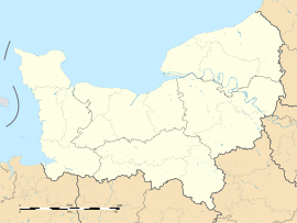
Gavrus is a commune. It is found in the Normandy region in the Calvados department in the northwest of France.
History
[change | change source]The name of the commune was first mentioned in 1222.[1] Gavrus was a Roman cognomen.[source?]
Population
[change | change source]| 1962 | 1968 | 1975 | 1982 | 1990 | 1999 | 2006 | |||||||||||||||||||||||||||||||||||||||||||||||||||||||||||||||||||||||||||||||||||||||||||||||||||||||||||||||||||||||||||||||||||||||||||||||||||||||||||||||||||||||||||||||||||||||||||||||||||||||||||||||||||||||||||||||||||||||||||||||||||||||||||||||||||||||||||||||||||||||||||||||||||||||||||||||||||||||||||||||||||||||||||||||||||||||||||||||||||||||||||||||||||||||||||||||||||||||||
|---|---|---|---|---|---|---|---|---|---|---|---|---|---|---|---|---|---|---|---|---|---|---|---|---|---|---|---|---|---|---|---|---|---|---|---|---|---|---|---|---|---|---|---|---|---|---|---|---|---|---|---|---|---|---|---|---|---|---|---|---|---|---|---|---|---|---|---|---|---|---|---|---|---|---|---|---|---|---|---|---|---|---|---|---|---|---|---|---|---|---|---|---|---|---|---|---|---|---|---|---|---|---|---|---|---|---|---|---|---|---|---|---|---|---|---|---|---|---|---|---|---|---|---|---|---|---|---|---|---|---|---|---|---|---|---|---|---|---|---|---|---|---|---|---|---|---|---|---|---|---|---|---|---|---|---|---|---|---|---|---|---|---|---|---|---|---|---|---|---|---|---|---|---|---|---|---|---|---|---|---|---|---|---|---|---|---|---|---|---|---|---|---|---|---|---|---|---|---|---|---|---|---|---|---|---|---|---|---|---|---|---|---|---|---|---|---|---|---|---|---|---|---|---|---|---|---|---|---|---|---|---|---|---|---|---|---|---|---|---|---|---|---|---|---|---|---|---|---|---|---|---|---|---|---|---|---|---|---|---|---|---|---|---|---|---|---|---|---|---|---|---|---|---|---|---|---|---|---|---|---|---|---|---|---|---|---|---|---|---|---|---|---|---|---|---|---|---|---|---|---|---|---|---|---|---|---|---|---|---|---|---|---|---|---|---|---|---|---|---|---|---|---|---|---|---|---|---|---|---|---|---|---|---|---|---|---|---|---|---|---|---|---|---|---|---|---|---|---|---|---|---|---|---|---|---|---|---|---|---|---|---|---|---|---|---|---|---|---|---|---|---|---|---|---|---|---|---|---|---|---|---|---|---|---|---|---|---|---|---|---|---|---|---|---|---|---|---|---|---|
| 112 | 111 | 127 | 161 | 196 | 218 | 439 | |||||||||||||||||||||||||||||||||||||||||||||||||||||||||||||||||||||||||||||||||||||||||||||||||||||||||||||||||||||||||||||||||||||||||||||||||||||||||||||||||||||||||||||||||||||||||||||||||||||||||||||||||||||||||||||||||||||||||||||||||||||||||||||||||||||||||||||||||||||||||||||||||||||||||||||||||||||||||||||||||||||||||||||||||||||||||||||||||||||||||||||||||||||||||||||||||||||||||
| From the year 1962 on: population without double counting—residents of multiple communes (e.g. students and military personnel) only counted once. . | |||||||||||||||||||||||||||||||||||||||||||||||||||||||||||||||||||||||||||||||||||||||||||||||||||||||||||||||||||||||||||||||||||||||||||||||||||||||||||||||||||||||||||||||||||||||||||||||||||||||||||||||||||||||||||||||||||||||||||||||||||||||||||||||||||||||||||||||||||||||||||||||||||||||||||||||||||||||||||||||||||||||||||||||||||||||||||||||||||||||||||||||||||||||||||||||||||||||||||||||
The population has grown because Gavrus is close to Caen, a big city.

References
[change | change source]- ↑ "History of Gavrus". Archived from the original on 6 February 2010. Retrieved 25 July 2010.
- ↑ Gavrus On Insee's website
Retrieved from "https://simple.wikipedia.org/w/index.php?title=Gavrus&oldid=9970290"
Hidden categories:
- Pages using gadget WikiMiniAtlas
- Pages using the JsonConfig extension
- Coordinates on Wikidata
- Pages using infobox settlement with image map1 but not image map
- All articles with unsourced statements
- Articles with unsourced statements from September 2022
- France geography stubs
- Pages using the Kartographer extension


