Houlgate
- Asturianu
- 閩南語 / Bân-lâm-gú
- Brezhoneg
- Català
- Cebuano
- Deutsch
- Ελληνικά
- English
- Español
- Esperanto
- Euskara
- Français
- Հայերեն
- Bahasa Indonesia
- Italiano
- Қазақша
- Kurdî
- Ladin
- Latina
- Magyar
- Bahasa Melayu
- Nederlands
- Нохчийн
- Occitan
- Oʻzbekcha / ўзбекча
- Piemontèis
- Polski
- Português
- Română
- Русский
- Slovenčina
- Suomi
- Svenska
- Татарча / tatarça
- Українська
- Vèneto
- Tiếng Việt
- Winaray
- 粵語
- 中文
Houlgate | |
|---|---|
 Town logo | |
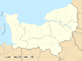
| Coordinates: 49°18′05″N 0°04′33″W / 49.3013888889°N 0.0758333333333°W / 49.3013888889; -0.0758333333333 | |
| Country | France |
| Region | Normandy |
| Department | Calvados |
| Arrondissement | Lisieux |
| Canton | Dozulé |
| Intercommunality | Estuaire de la Dives |
| Government | |
| • Mayor (2008–2014) | Jean-Claude Pupin |
| Area 1 | 4.69 km2 (1.81 sq mi) |
| Population (2006) | 1,902 |
| • Density | 410/km2 (1,100/sq mi) |
| Time zone | UTC+01:00 (CET) |
| • Summer (DST) | UTC+02:00 (CEST) |
| INSEE/Postal code | 14338 /14510 |
| 1 French Land Register data, which excludes lakes, ponds, glaciers > 1 km2 (0.386 sq mi or 247 acres) and river estuaries. | |
Houlgate is a small tourist resort in northwestern France along the English Channel with a beach and a casino. It is a commune in the Calvados department in the Normandy region.
History
[change | change source]It began as a hamlet in the commune of Beuzeval which was a very old parish and was part of the fiefdom of the Aché (or Achey). There were many different lords because several different families inherited the title through marriage, until gradually the land of the Beuzeval was sold to farmers. The parish was eventually controlled by Houlgate. On the south side of the river Drochon, between 1845 and 1850, sea bathing attracted summer visitors.
Geography
[change | change source]Houlgate is located along the English Channel in the valley of the Drochon. The valley is mostly built up or used for animal grazing. The town's area is 4.69 km² and the average altitude 5 m. Despite its low average height, the town contains two hills which form the natural limits of the commune.


